Catalog Archive
Auction 179, Lot 31

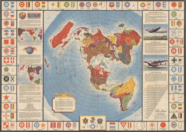
"Global Map for Global War and Global Peace",

Subject: World, World War II

Period: 1943 (dated)

Publication:

Color: Printed Color

Size:
23.9 x 33.4 inches
60.7 x 84.8 cm
Download High Resolution Image
(or just click on image to launch the Zoom viewer)

This pamphlet contains a very graphic and detailed World War II era map published by the Aluminum Company of America (Alcoa). It was designed on a north polar projection to demonstrate "the fact that the aeroplane changes our old earth-bound ideas as a map like this. The air is a universal highway. Flying routes naturally go across, not around." Flanking the map is text explaining the difference between the commonly seen Mercator projection and the polar projection along with opportunities in the aviation industry. The border includes airplane insignia for various nations (including Nazi Germany), and the verso is filled with additional illustrations including both "friendly" and "enemy" airplanes, plane formations, stunts, and various insignias for the U.S. Army, Navy, and Marines.

References: Rumsey #6781.003.

Condition: A

A very colorful example, issued folding.

Estimate: $140 - $170

Sold for: $100

Closed on 9/16/2020

Archived