Catalog Archive
Auction 179, Lot 295

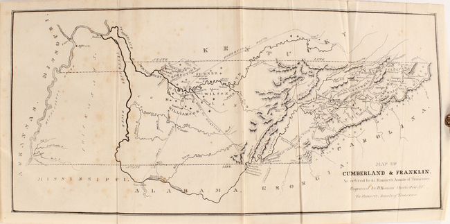
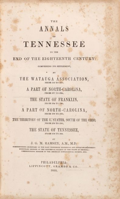
"[Book with Map] The Annals of Tennessee to the End of the Eighteenth Century...",

Subject: Tennessee, Franklin

Period: 1853 (published)

Publication:

Color: Black & White

Size:
17 x 7.9 inches
43.2 x 20.1 cm
Download High Resolution Image
(or just click on image to launch the Zoom viewer)

This is the first edition of J.G.M. Ramsey's book printed in Philadelphia by Lippincott, Grambo & Co. The volume investigates the state's political history and key residents from its beginnings as the Watuga Assocition in 1769 to statehood in 1796. In between, the author covers stints with North Carolina and the ephemeral State of Franklin. The 774 pages of text are augmented by a folding map at the front of the volume entitled Map of Cumberland & Franklin. As Refered to in Ramsey's Annals of Tennessee (17 x 8") that shows early settlements particularly in the areas around Knoxville and Nashville along with several early trails including Robertson's Route, the Great Indian War Path, and Army Route to name a few. Octavo, rebound in quarter brown cloth over marbled boards with original spine label present.

References: Howes #R-43; Sabin #67729.

Condition: B+

The folding map is very good with scattered foxing. Text is mostly clean with occasional foxing that is more prominent in the first 10 pages. Rebound with light wear to covers, and most of the original spine label has been adhered onto the new spine.

Estimate: $275 - $350

Sold for: $1,100

Closed on 9/16/2020

Archived