Catalog Archive
Auction 179, Lot 22

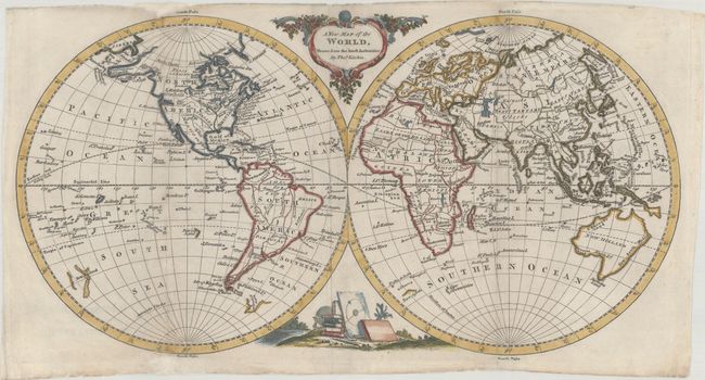
"A New Map of the World, Drawn from the Latest Authorities", Kitchin, Thomas

Subject: World

Period: 1779 (circa)

Publication: A New Geographical, Historical and Commercial Grammar

Color: Hand Color

Size:
14.8 x 7.8 inches
37.6 x 19.8 cm
Download High Resolution Image
(or just click on image to launch the Zoom viewer)

This charming small double-hemisphere map contains almost as much detail in the oceans as on land, with dozens of named islands. The continents contain information on country borders, rivers, major lakes, but just a few cities, including Santa Fe in both North and South America. The British Empire is noted east of the Mississippi River with Louisiana and Mexico to the west. Alaska is shown in a very rudimentary shape, and a River of the West extends from the West Coast nearly to the Mississippi River, passing through Pikes Lake. In the South Pacific, Tasmania is still connected to Australia, labeled New Holland, and an odd partial coastline floats just west of New Zealand. Two additional partial coastlines, Gulf of St. Sebastian and Terra Australis, appear in the South Atlantic Ocean. The map is adorned with a decorative cartouche and a vignette with a globe, a celestial chart, and a stack of books. Published in William Guthrie's A New Geographical, Historical and Commercial Grammar.

References: McCorkle (18th C. Geography Books) #162-1.

Condition: B+

A nice impression, issued folding, and now flattened with folds archivally reinforced on verso. There is minor soiling and additional archival repairs adjacent to the North and South Poles in the western hemisphere.

Estimate: $400 - $500

Sold for: $300

Closed on 9/16/2020

Archived