Catalog Archive
Auction 179, Lot 198

"Map No. 10. United States", Cady & Burgess
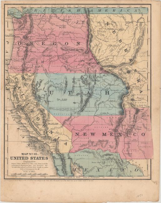
Subject: Western United States

Period: 1851 (dated)

Publication:

Color: Hand Color

Size:
9 x 10.4 inches
22.9 x 26.4 cm
Download High Resolution Image
(or just click on image to launch the Zoom viewer)

A nice map of the West that displays early territorial boundaries with many Indian tribes and military forts located. New Mexico Territory includes the northern extension into today's Colorado, and the southern border is pre-Gadsden Purchase. Oregon Territory extends to the Continental Divide and a huge Nebraska occupies the area to the east. The large Utah Territory extends to the Continental Divide with Salt Lake City as its capital. Each state/territory is labeled with their population: Utah 11,000; New Mexico 62,000; Oregon 13,000; California 165,000. The 1853 edition of this map notes California's population as 264,000, a 60% increase due to the Gold Rush.

References:

Condition: B+

Light scattered foxing.

Estimate: $110 - $140

Sold for: $170

Closed on 9/16/2020

Archived