Catalog Archive
Auction 179, Lot 17

"Tabula Geographica Utriusque Hemisphaerii Terrestris Exhibens Declinationem Acus Magneticae...", Rhode, Johann Cristoph
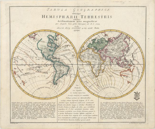
Subject: World

Period: 1744 (dated)

Publication: Atlas Geographicus...

Color: Hand Color

Size:
14.6 x 12.4 inches
37.1 x 31.5 cm
Download High Resolution Image
(or just click on image to launch the Zoom viewer)

An attractive double-hemispheric world map showing lines of magnetic variation. In the western sphere, North America is shown with a bulging western coast above the Strait of Martin de Aguilar. The mythical lakes of Parime and Xarayes appear in South America, and a partial coastline for New Zealand is depicted in the southern Pacific. In the eastern sphere, Australia is still connected to New Guinea and has a partial border along with Tasmania to its south. Includes three panels of explanatory text in Latin at bottom. Based upon works by Rhode, this map was prepared by Nicolaus Friedrich Sauerbrey for the Royal Prussian Academy of Sciences and was published in Leonhard Euler's Atlas Geographicus. The customary Prussian privilege seal is shown at lower right. Dated 1744, but published circa 1753.

References:

Condition: A

On a clean sheet of watermarked paper with a few tiny edge tears confined to the bottom blank margin that have been closed on verso with archival tissue.

Estimate: $275 - $350

Sold for: $160

Closed on 9/16/2020

Archived