Catalog Archive
Auction 179, Lot 119

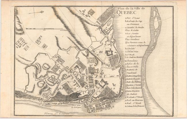
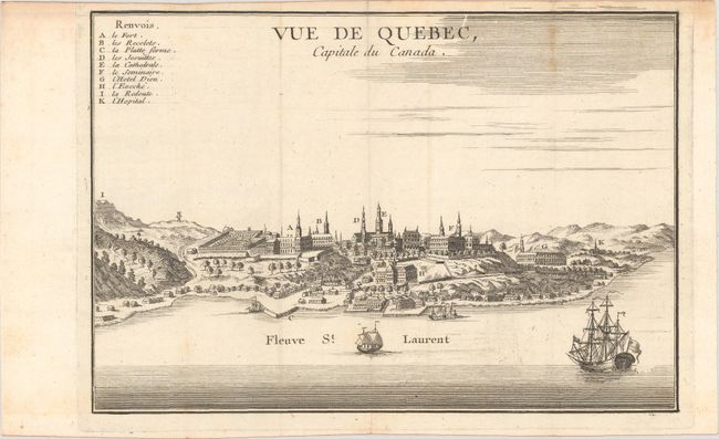
"[Lot of 2] Plan de la Ville de Quebec [and] Vue de Quebec, Capitale du Canada", Le Rouge, George Louis

Subject: Quebec, Canada

Period: 1755 (circa)

Publication: Recueil des Plans de l'Amerique Septentrionale...

Color: Black & White

Size:
10 x 7 inches
25.4 x 17.8 cm
Download High Resolution Image
(or just click on image to launch the Zoom viewer)

This pair of rare engravings of Quebec appeared in George Louis Le Rouge's French and Indian War-era collection Recueil des Plans de l'Amerique Septentrionale... The plan is copied from the influential Bellin-Charlevoix map of 1744. A key locates 23 places of interest including Fort St. Louis, the Hotel-Dieu de Quebec, and various fortifications. North is oriented to the right. The handsome view captures the city from the vantage of the St. Lawrence River, with ships drifting by in the foreground. Ten locations of interest are identified by a key at top left. There is nice detail of the city's architecture and fortifications.

References: Kershaw #1052; Shirley (BL Atlases) T.LER-1a #2 & #3

Condition: B+

Issued folding on watermarked paper with some light offsetting.

Estimate: $275 - $350

Sold for: $200

Closed on 9/16/2020

Archived