Catalog Archive
Auction 178, Lot 597

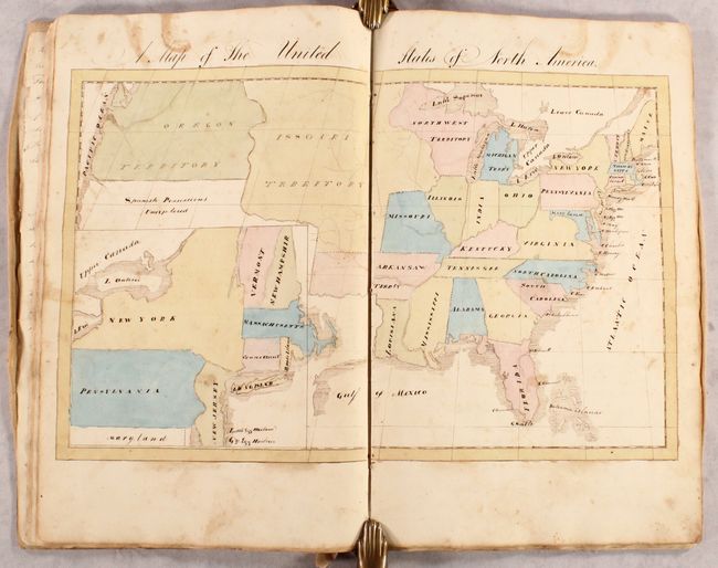
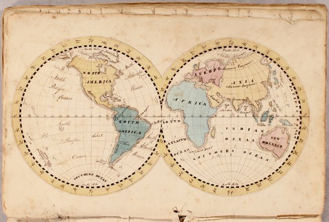
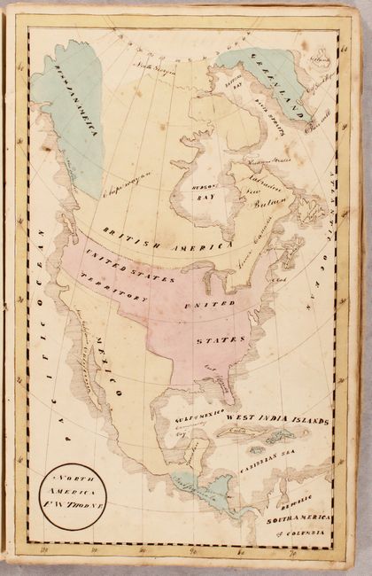
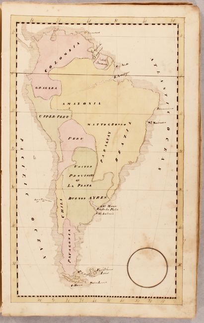
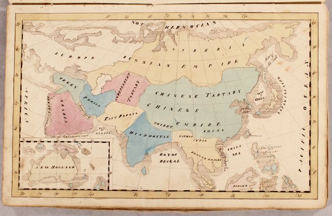
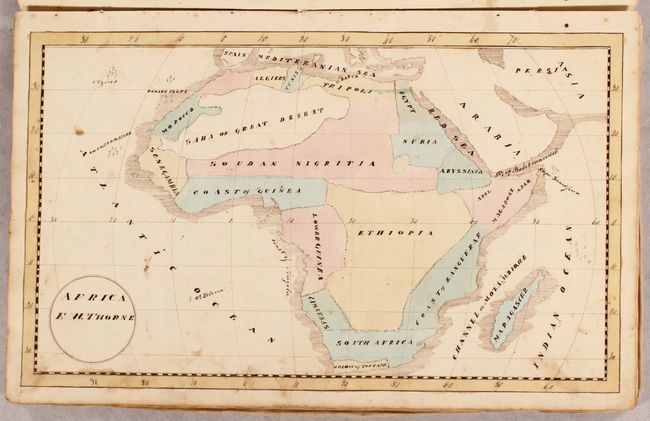
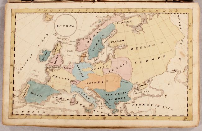
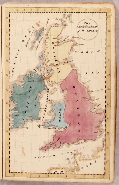
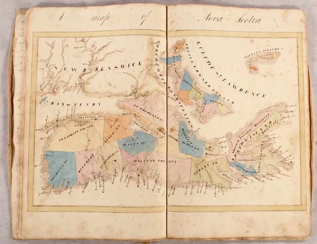
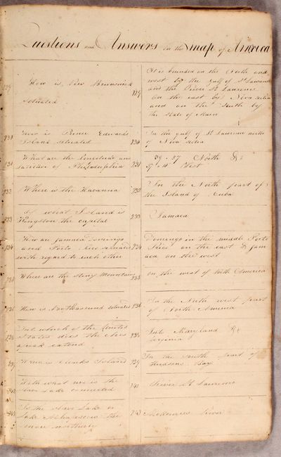
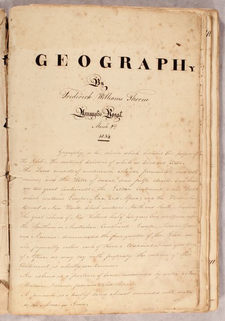
Manuscript Geography Book with 9 Maps and Colorful Commentary

"Geography",

Subject: Geography Books

Period: 1834 (dated)

Publication:

Color: Hand Color

Size:
10.3 x 16 inches
26.2 x 40.6 cm
Download High Resolution Image
(or just click on image to launch the Zoom viewer)

This is a fascinating manuscript geography book created as a tutor's guide by Frederick Williams Thorne from Annapolis Royal and dated 2 March 1834. The geography book includes 9 maps: world, the 5 continents, the United States, Nova Scotia, and the British Isles. Each map is accompanied by several pages of manuscript notes on the people, politics, natural resources, key cities, and other details. Facts and figures are interspersed with the author's own commentary:

On the United States : "These states are in a very flourishing and improving condition and promise to become, on the abolition of slavery which they now tolerate, the most powerful and happy community in the world."

On Europe: "Europe ... is inhabited by an active and intelligent race of mankind, who possess extensive dominions and have a preponderating influence in the other parts."

On the Kingdom of Great Britain: "Great Britain is the undisputed mistress of the seas, which are every where covered with her ships; and her wealth the ingenuity of her manufacturers, and the extent of her commerce are unequaled. The industry and intelligence of her inhabitants, the excellent form of her political constitution, the representative system, the trial by jury and the independence of her insular situation render her an abject of admiration to all nations."

On Asia: "The southern Asiatics are in general affeminate, [illegible], indolent and servile; but they evince considerable genius in various arts and sciences."

On Africa: "Even man on this quarter of the world, exists in a state of the lowest barbarism."

Also included are extensive lists of questions and answers (nearly 400!) for the maps, as well as a list of "Promiscuous Questions," such as "For what is Germany remarkable?" and "Is Russia famous for its inland navigation?"

The maps show the continents and countries in simple outline, labeled with the names of countries, larger bodies of water, islands, and capes. The map of the United States shows large territories in the west, including Oregon, Missouri, Arkansaw, and Northwest Territory. States are delineated and named but no cities are identified. The Southwest is labeled "Spanish Possessions Unexplored" and is covered by a large inset showing New England in greater detail, with Long Island shown quite a distance from New York.

Folio; 9 maps; 22 pp. of text; 35 pp. of questions. Bound in paper boards covered in a linen dust jacket.

References:

Condition: B

The maps are beautifully drawn and hand colored by the original author on paper is watermarked "Collins 1824." There is light to moderate soiling and foxing on the maps and text pages. The title page and world map have a short tear and a couple of small holes along the binding edge. The text page on Africa has a long tear that has an old tissue repair. The text page on North America has a short tear at bottom with an old paper repair. The original thread that stitched together the pages is perished and the text page on Europe is nearly detached. The linen dust jacket is stained and torn in a number of places.

Estimate: $1,500 - $2,500

Sold for: $1,000

Closed on 6/10/2020

Archived