Catalog Archive
Auction 178, Lot 591

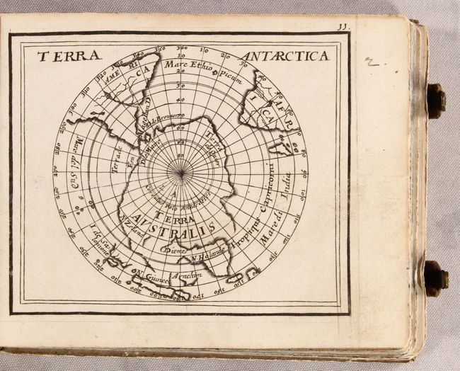
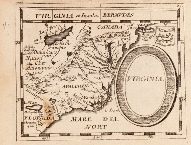
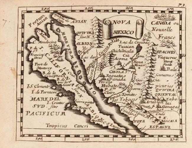
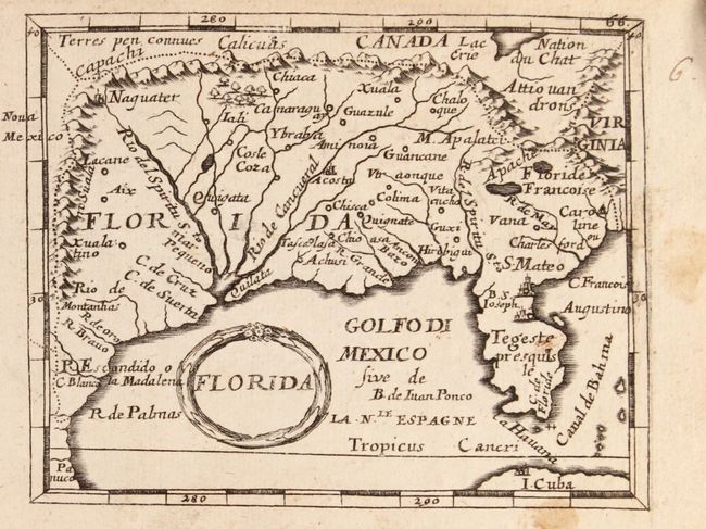
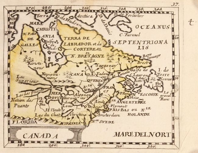
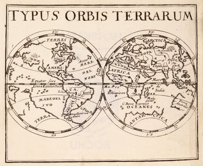
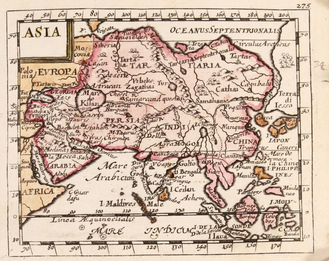
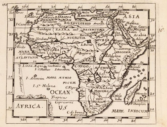
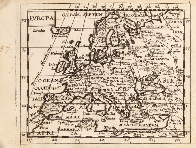
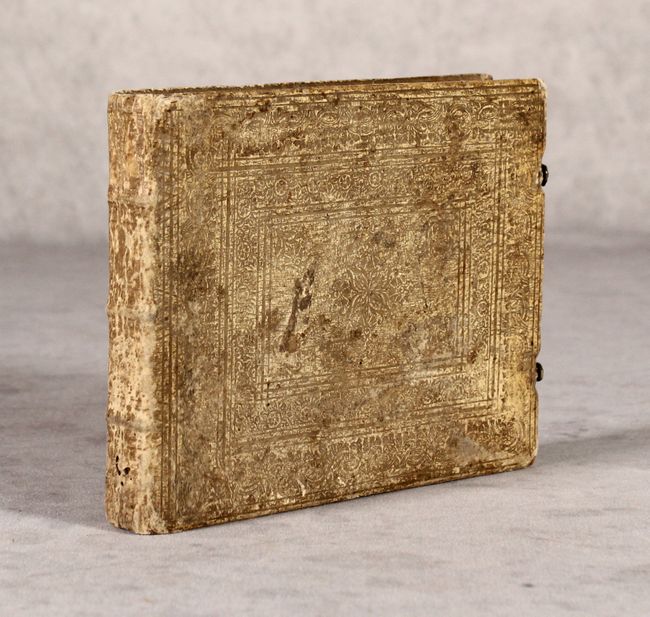
Miniature Atlas with 82 Maps Based on Duval

"[Geographia Universalis...]", Duval/Beer

Subject: Atlases

Period: 1678 (published)

Publication:

Color: Black & White

Size:
6.1 x 4.9 inches
15.5 x 12.4 cm
Download High Resolution Image
(or just click on image to launch the Zoom viewer)

Terrific miniature atlas published by Johann Christoff Beer with 82 copper-engraved maps and 8 pages of crests, two folding. The maps are based on those in Pierre Duval's La Geographie Universelle, first published in 1661. Beer had the maps re-engraved by Sigismund G. Hipschman (whose signature appears on the world map) with Latin titles replacing the original French titles. All maps are present although there is no title page or text pages, and the list of maps is in manuscript. The atlas includes a double-hemisphere world map (Shirley #478), all continents and scores of country and island charts. There are six America-related maps that are referenced by Burden: America (#499), Terra Arctica (#500), Canada (#501), Virginia (#502), Florida (#503), and Nova Mexico (#504). Terrific individual maps of Antarctica, Iceland, Congo, Maldives, Ceylon, Japan, Sicily, and many more. Five of the maps (America, Canada, Asia, France, and Azores Islands) are in early, simple, hand coloring, likely by original owner. The majority of the maps have been pasted together so they appear to be printed both sides. This appears original, or at least very early to the atlas based on wear and soiling of joined foredges. The original vellum binding is finely tooled with two brass clasps in fine working condition. Of particular note are the following maps:

The map of the Americas shows California as an island and the F. d'Anien separating California from a huge Terre de Iesso. The Spanish colony of Sa. Fe is identified, Quebec is shown as the capital of the French possessions and St. Augustine is shown in Florida. N. Suede is incorrectly shown, as the Dutch took possession of that colony in 1655. In the Pacific, the recently discovered coastline of New Zealand is depicted; but it incorrectly runs in an east-west orientation. In South America the mythical city of Manoa appears on a spurious large lake that straddles the equator.

The map of Virginia covers the coastline from Long Island to the May R. in South Carolina and inland to Lake Erie and the mythical Lake May. It depicts the defunct Swedish colony, the Dutch colony of New York (Nouvel Amsterdam), and the French claim to Florida. The colony of Virginia is shown with Jamestown and the Indian city of Orapaks. In the west is a large Lac Erie ou Lac du Chat (named for the panther like fierceness of its Indian inhabitants). Several Native Indian tribes are named, including Iroquois. A tiny inset map of the island of Bermuda is included above the bold oval title cartouche. An alternate title Virginia et Insulae Bermudes appears across the top.

The island of California is the main focus of the map of Nova Mexico. The map is filled with place names including the mysterious seven cities of Cibola. The Rio Nort (Rio Grande) originates from a large Lac de Conibas and incorrectly flows into the Mare Vermeio. The map is based on Sanson's Audience de Guadalajara (1657) with the addition of the Fretum Anian above the island and several unnamed, north-south, mountain ranges.

References: cf. Shirley (BL Atlases) T.BEER-1a.

Condition:

Early and dark impressions. Some maps with a little soiling tending toward very good (B+), but most are near fine (A). A few maps with old paper tape repairs to binding straps. Binding is rubbed and soiled with worm track at lower spine. Blank free end paper with ex libris stamp: Hanskarl Rochu and nineteenth century owner's name on front end paper in ink.

Estimate: $5,500 - $6,500

Unsold

Closed on 6/10/2020

Archived