Catalog Archive
Auction 178, Lot 539

"Carte Generale des Decouvertes de l'Amiral de Fonte Representant la Grande Probabilite d'un Passage au Nord Ouest", Robert de Vaugondy, Didier

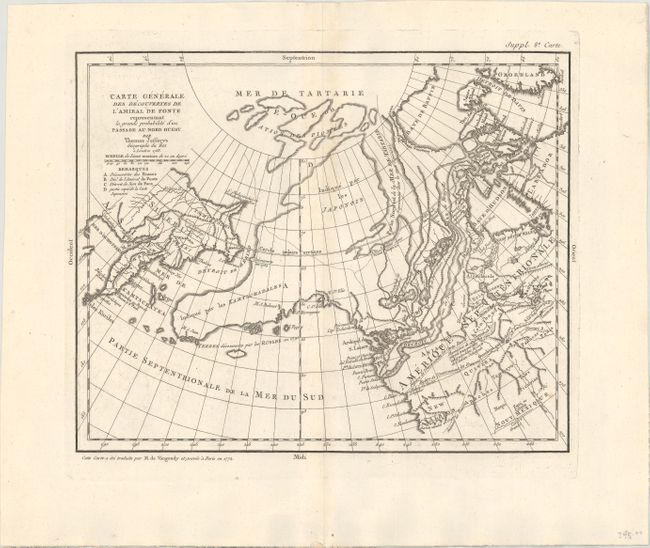
Subject: North Pacific Ocean

Period: 1772 (dated)

Publication: Diderot's Encyclopedie (Supplement)

Color: Black & White

Size:
14 x 11.4 inches
35.6 x 29 cm
Download High Resolution Image
(or just click on image to launch the Zoom viewer)

The Encyclopedie was published under the direction of Diderot from 1751 onward with thousands of articles written by the most prominent philosophers and scientists of the time. These great minds collaborated in the goal of assembling and disseminating the fruits of accumulated knowledge and learning. This massive reference work for the arts and sciences, served to propagate Enlightened ideas. Read a full description of this work and Diderot at Wikipedia.com.

This is probably the most extravagant of all the Northwest Passage maps based on the Jefferys model. Thomas Jefferys was an ardent believer in the northern route to Asia through a passage described by Juan de Fuca in 1592 and in the fictitious story of Bartholomew de Fonte's discoveries in 1640. Alaska is shown in an early, peninsular form based on the map of Mueller. This map is from a series prepared by Didier Robert de Vaugondy to illustrate the articles written by Samuel Engel concerning the recent discoveries and cartographic theories in the northern regions.

References: cf. Hayes. pp. 26-27; Pedley #455 and pp. 74-78; Wagner (NW) #637.

Condition: A

A crisp impression on watermarked paper with faint offsetting.

Estimate: $110 - $140

Sold for: $80

Closed on 6/10/2020

Archived