Catalog Archive
Auction 178, Lot 538

"Nouvelle Carte des Decouvertes Faites par des Vaisseaux Russiens aux Cotes Inconnues, de l'Amerique Septentrionale avec les Pais Adiacents...",

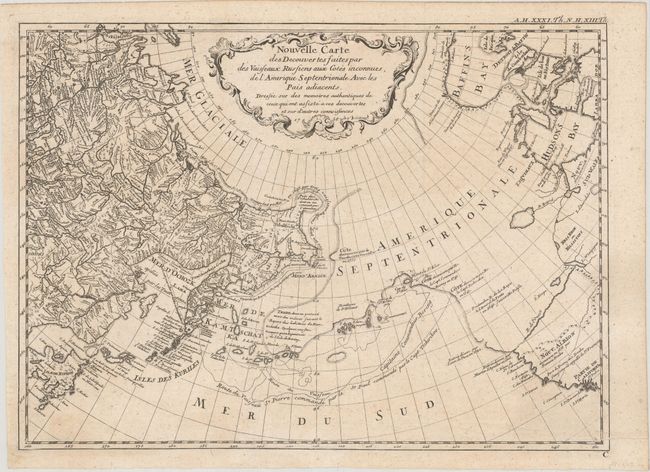
Subject: North Pacific Ocean

Period: 1758 (dated)

Publication:

Color: Black & White

Size:
13.7 x 9.9 inches
34.8 x 25.1 cm
Download High Resolution Image
(or just click on image to launch the Zoom viewer)

This is a rare, reduced-size version of Gerhard Muller's landmark map of 1754 showing the discoveries of Captains Bering and Tschirikow. Muller was a German scholar who worked for the Russian Imperial Academy of Sciences. He originally published his map in response to Joseph Delisle and Philippe Buache's map that showed previously unknown Russian discoveries and an elaborate (and entirely speculative) depiction of the imaginary voyage of Admiral De Fonte through a Northwest Passage. Muller's map shows an elongated landmass roughly in the shape of the Alaskan Peninsula and the Aleutian Islands. The speculative Northwest Passage is shown nearly connecting to Hudson Bay via a mythical River of the West. Muller's map was copied numerous times by different publishers due to increased interest in the region and the De Fonte controversy. This is a rare and fascinating addition to any collection of the Pacific Northwest.

References: Falk #1758-1, cf. Hayes, p. 29-32; Wagner #615.

Condition: A

Issued folding on paper with an "AR" watermark and some light creasing along the bottom of the sheet.

Estimate: $475 - $600

Sold for: $275

Closed on 6/10/2020

Archived