Catalog Archive
Auction 178, Lot 221

"Carte des Isles de l'Amerique et de Plusieurs Pays de Terre Ferme Situes au Devant de ces Isles & Autour du Golfe de Mexique...", Anville, Jean Baptiste Bourguignon d'

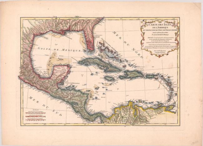
Subject: Gulf of Mexico & Caribbean

Period: 1731 (dated)

Publication:

Color: Hand Color

Size:
17.8 x 12.1 inches
45.2 x 30.7 cm
Download High Resolution Image
(or just click on image to launch the Zoom viewer)

This detailed map covers the southern U.S., Central America, the West Indies, and northern South America. The map is dense with town names, waterways, and mountains. Florida features prominently here, stretching west just past Mobile Bay to Louisiane and north to Caroline, with its southern portion broken into an archipelago. A decorative title cartouche appears in the top right corner. Engraved by Delahaye.

References:

Condition: B+

A crisp impression on a bright, sturdy sheet of watermarked paper with a few light spots of foxing.

Estimate: $275 - $350

Sold for: $220

Closed on 6/10/2020

Archived