Catalog Archive
Auction 178, Lot 177

"A Map of Cape Cod",

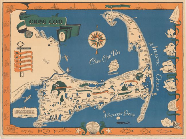
Subject: Cape Cod, Massachusetts

Period: 1940 (circa)

Publication:

Color: Printed Color

Size:
35.1 x 25.8 inches
89.2 x 65.5 cm
Download High Resolution Image
(or just click on image to launch the Zoom viewer)

This vivid pictorial map of Cape Cod is by Paul Paige of East Brewster, Massachusetts. It highlights the Cape's many attractions with charming illustrations. Among the sites depicted are the Pilgrim's Monument, numerous lighthouses, "fall hunting in the great marshes," Camp Edwards, Shawme-Crowell State Forest, and the Woods Hole Oceanographic Institute. The key identifies airports, golf courses, life saving stations, and yacht clubs. Mermaids guard the entrances of the Cape Cod Canal, which is spanned by two bridges. A whale and numerous boats appear in the water. The decorative compass rose has a fisherman at its center. The surrounding border features illustrations of various activities, sea life, and ships. A crowned fish and the state's coat-of-arms are incorporated into the decorative title cartouche. As the poem at bottom left states, "If you have ever been there, this map is meant for you."

References: Rumsey #11271.

Condition: A

There is some extraneous creasing at top and some tiny edge tears in the margins.

Estimate: $325 - $400

Sold for: $250

Closed on 6/10/2020

Archived