Catalog Archive
Auction 178, Lot 122

Ernest Clegg's Map Commemorating George Washington

"A Descriptive Map of the Region Within One Hundred Miles of the Capital of the United States...",

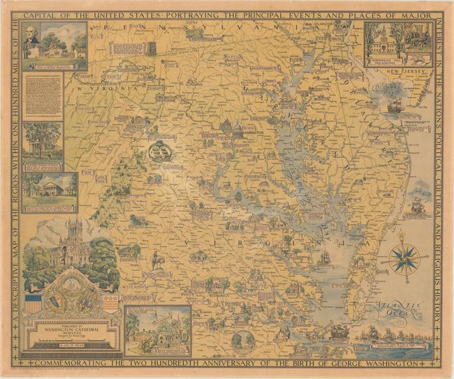
Subject: Mid-Atlantic United States

Period: 1932 (dated)

Publication:

Color: Printed Color

Size:
33.3 x 27.6 inches
84.6 x 70.1 cm
Download High Resolution Image
(or just click on image to launch the Zoom viewer)

This large map by Ernest Clegg was created to commemorate the 200th anniversary of George Washington's birth and shows the region surrounding Washington, DC, identifying the "principal events and places of major interest in the nation's political, cultural and religions history." All of Maryland and Delaware are shown, along with parts of Virginia, Pennsylvania and West Virginia. Insets of important buildings surround the map, including Mount Vernon, Independence Hall in Philadelphia, the Virginia State Capitol building in Richmond, the Rotunda at the University of Virginia, and William and Mary College. Many other important buildings are depicted and labeled throughout the map and battle sites are also noted. The map was published by the Washington Cathedral, now known as the Washington National Cathedral, an image of which also graces a cartouche with the publisher's imprint and scale of miles. Printed by William Edwin Rudge, Inc. in New York.

References: Hornsby (Picturing America) #25.

Condition: B

Lightly toned and professionally backed in thin, archival tissue to repair some short tears and cracks.

Estimate: $800 - $1,000

Sold for: $500

Closed on 6/10/2020

Archived