Catalog Archive
Auction 178, Lot 109

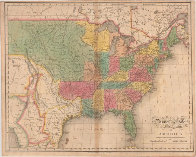
"[Lot of 2] Map of the United States of America [and] United States of America Compiled from the Latest & Best Authorities",
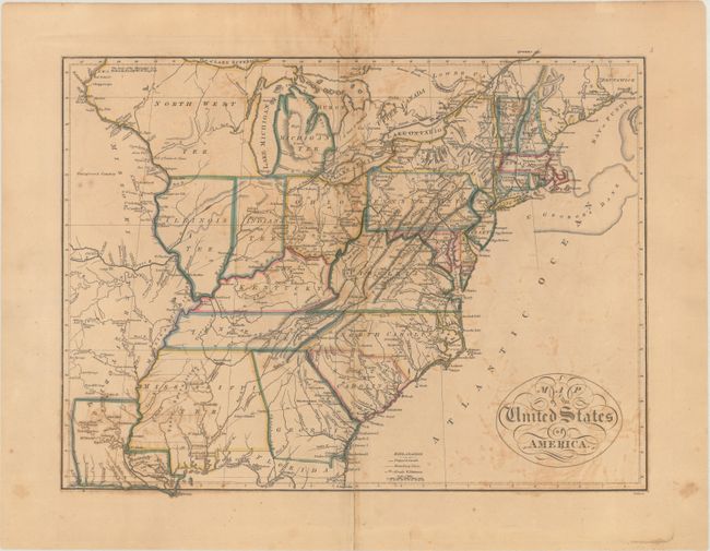
Subject: Eastern United States

Period: 1814-21 (circa)

Publication:

Color: Hand Color

Size:
See Description
Download High Resolution Image
(or just click on image to launch the Zoom viewer)

A. Map of the United States of America, by Mathew Carey, circa 1814 (17.4 x 13.4"). This map of the young United States extends just beyond the Mississippi River. The mid-western territories are a bit misaligned with Indiana shown directly below Lake Michigan and Chicago appearing in North West Territory. West of the Mississippi River is the large Missouri Territory stretching northwards from Louisiana. Major roads with distances, proposed canals, cities, forts, and Indian villages are among the interesting details illustrated on the map. A notation of Yazoo Speculation in Mississippi refers to the Yazoo Land Fraud perpetrated in 1789-1796 when the region was part of Georgia Territory. Three companies bribed and intimidated a bill through the Georgia assembly that allowed them to purchase millions of acres of land for next to nothing, resulting in a huge public outcry. The bill's supporters were swiftly voted out of power, and Senator James Jackson took office. He vowed to repeal the Yazoo Act if it cost him his life, saying he would repeal it even if he had to shoot everyone involved in passing it. He didn't have to shoot anyone, and the law was rescinded in 1796. The fact it is shown on a map produced many years later attests to the importance attributed to this fraudulent scheme. Condition: There is scattered foxing, light offsetting, and dampstaining along the centerfold. A 3" centerfold separation has been closed on verso with archival tape.

B. United States of America Compiled from the Latest & Best Authorities, by John Melish, from A Complete Genealogical, Historical, Chronological and Geographical Atlas, dated 1821 (21.1 x 16.8"). An important map by the American cartographer John Melish, engraved by Benjamin Tanner, and published by Mathew Carey & Son for C. V. Lavoisne's atlas. It provides a detailed view of the Missouri River and the headwaters of the Columbia River based on information from Lewis and Clark's expedition. The new state of Missouri is shown with a straight western border. Michigan Territory includes the eastern part of present-day Wisconsin, which is still a part of the North West Territory. The large Arkansas Territory takes in most of present-day Oklahoma. Texas is a part of Mexico. One of the most interesting features of the map is the river system in the West, near the Highest Peak, where the headwaters of several major rivers all originate within a few miles of one another - Red River of California (Colorado), Multnomah (Willamette), Rio del Norte (Rio Grande), Arkansaw (Arkansas), and the Platte. Reference: Wheat (TMW) #338. Condition: There is toning along the centerfold, small stains at bottom, and a few centerfold separations that have been closed on verso with cello tape.

References:

Condition: B

See description above.

Estimate: $700 - $850

Sold for: $450

Closed on 6/10/2020

Archived