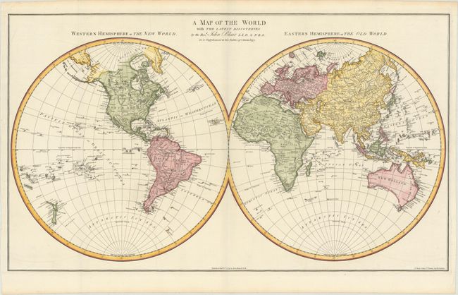
"A Map of the World with the Latest Discoveries", Blair, Rev. John
Subject: World
Period: 1779 (dated)
Publication: The Chronology & History of the World...
Color: Hand Color
Size:
27.7 x 16.1 inches
70.4 x 40.9 cm
An attractive, double-hemispheric map of the world. In North America, the United States is named and confined to east of the Appalachian Mountains. Further west is the large Louisiana and New Mexico, and a dotted line connects the Missouri River to the Columbia River. While the Alaskan coastline is still evolving, the Aleutian Islands are well developed. In South America, the mythical Lake Xarayes is still depicted. The Australian coastline is completely mapped, and Tasmania is correctly shown as an island. Published in a later edition of John Blair's The Chronology & History of the World.
References: Shirley (BL Atlases) G.BLAI-1b #1a.
Condition: A+
A fine impression on watermarked paper. Issued folding.