Catalog Archive
Auction 177, Lot 351

"Karte des Abendlaendischen Weltmeeres, und Eines Theils von dem Mitternaechtigen America...", Bellin, Jacques Nicolas

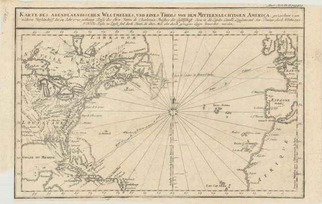
Subject: North Atlantic

Period: 1744 (dated)

Publication:

Color: Black & White

Size:
14.5 x 9.5 inches
36.8 x 24.1 cm
Download High Resolution Image
(or just click on image to launch the Zoom viewer)

A German edition of Bellin's attractive chart of the Atlantic, from about 15° north latitude with rhumb lines radiating from 32 points topped with a fleur-de-lis. A good portion of Europe and Africa is depicted, but with only a few coastal place names. Most of the settled parts of North America are mapped with the interior topography shown. The British colonies and French Louisiane are both delineated, and several French sea routes are shown. The map is based on information from the 1720 journal of Charlevoix. Engraved by Desbruslins.

References:

Condition: B+

Issued folding with a few minor spots in the image and a small binding trim at lower left.

Estimate: $140 - $170

Sold for: $100

Closed on 4/29/2020

Archived