Catalog Archive
Auction 177, Lot 21

"Regiones Sub Polo Arctico", Blaeu, Willem
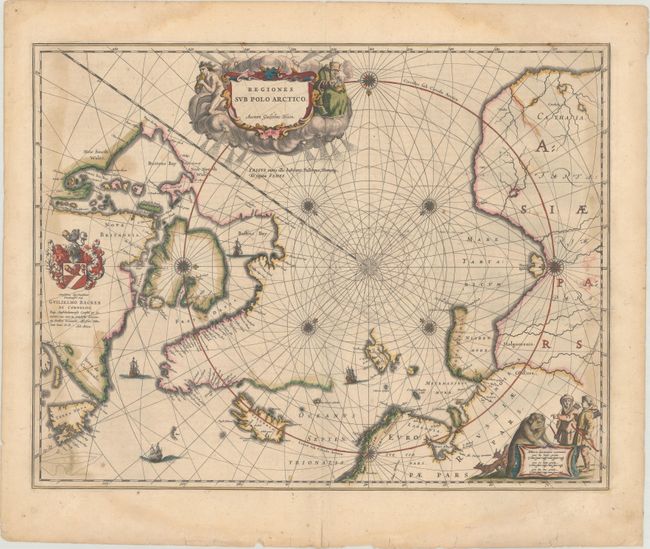
Subject: North Pole

Period: 1644 (circa)

Publication: Theatrum Orbis Terrarum

Color: Hand Color

Size:
20.9 x 16.2 inches
53.1 x 41.1 cm
Download High Resolution Image
(or just click on image to launch the Zoom viewer)

This important prototype map of the Arctic incorporates new information from the explorations of Capt. Thomas James with the bay named for him labeled here James his Bay. The Arctic coast of Russia provides information from Willem Barentsz' voyage, and Spitsbergen is shown according the Danish expedition of James Hall. Rhumb lines radiate from the North Pole, and a large title cartouche, with two figures and numerous wind heads, conveniently hides the northwest coast of America. The map is further decorated with several compass roses, ships, and an additional cartouche that features men in parkas, a polar bear, and foxes. Dedication to Guilielmo Backer de Corneliis (with Johanes Blaeu's imprint), indicates this issue is from the second state of the plate. Latin text on verso, published between 1644-655.

References: Burden #252; Goss (Blaeu) #2; Van der Krogt (Vol. II) #0020:2.2.

Condition: B+

There are large faint dampstains along the sheet's edges that enter into the map image at left and right. There is a tiny hole in the left border only visible when held to light, and some minor ink residue adjacent to the right border.

Estimate: $600 - $750

Sold for: $450

Closed on 4/29/2020

Archived