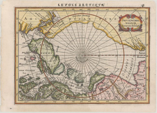
"Septentrionalium Terrarum Descript.", Mercator/Jansson
Subject: North Pole
Period: 1630 (published)
Publication: Atlas Minor
Color: Hand Color
Size:
7.9 x 5.7 inches
20.1 x 14.5 cm
This is the first state of this small map of the North Pole that was first issued in 1628. Jansson's map for the Mercator Atlas Minor does not follow Mercator, but used the knowledge of the many recent exploratory voyages that attempted to locate a northern route to Asia. Several fictitious islands, including Frisland, appear in the North Atlantic. It is decorated with a strapwork title cartouche. French text on verso.
References: Burden #222; Van der Krogt (Vol. III) #0020:352.1.
Condition: A
A dark impression on a bright sheet of watermarked paper with a few minute worm holes in the border at top left.