Catalog Archive
Auction 176, Lot 38

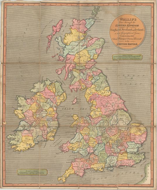
"Wallis's Tour Through the United Kingdom of England, Scotland and Ireland, a New Geographical Game, Comprehending All the Cities, Principal Towns, Rivers &c. in the British Empire", Wallis, John

Subject: Cartographic Miscellany, Game, Britain

Period: 1811 (dated)

Publication:

Color: Hand Color

Size:
18.4 x 22.3 inches
46.7 x 56.6 cm
Download High Resolution Image
(or just click on image to launch the Zoom viewer)

This early and uncommon map game leads players across all of Britain and Ireland with stops at various destinations along a numbered path. The game begins at Windsor (#1) and ends when the first player gets to London (#190). The map is intended to be accompanied by a 24 page booklet (not present) that provides both descriptive information and specific instructions for each of the numbered towns (earlier versions had this text flanking the map). Dissected map laid on original linen. Slipcase is not present.

Map games were a popular sideline for cartographic publishers from about 1760 onward in England, with John Bowles publishing the earliest geographical game in 1759. John Wallis Sr. and his son Edward began working together as mapsellers and publishers, and by the 1790s, Wallis' business began to focus on map games, at which point he began to dominate the London market for such items.

References:

Condition: B+

There are some light dampstains along the folds and minor soiling. Dissected and backed with original linen. Slipcase not present.

Estimate: $375 - $450

Sold for: $250

Closed on 2/12/2020

Archived