Catalog Archive
Auction 175, Lot 28

"Northern Hemisphere", Faden, William
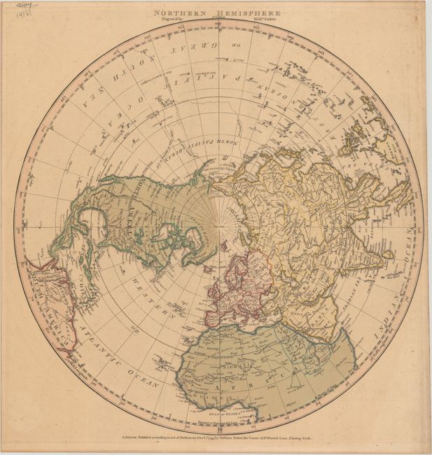
Subject: North Pole

Period: 1790 (dated)

Publication:

Color: Hand Color

Size:
13.6 x 13.8 inches
34.5 x 35.1 cm
Download High Resolution Image
(or just click on image to launch the Zoom viewer)

This simple, handsome map features Captain Cook's tracks in the Pacific where the island archipelagos are well mapped. It depicts a fairly well developed Alaska, but Vancouver Island is missing off the Pacific coast of Canada. In Africa, the Nile is shown emanating from two tiny lakes in the Mtns. of the Moon, the Sahara is labeled Sahra or Desert of Barbary, and the Barbary coast is noted as Country of Dates. William Faden took over the map business of Thomas Jefferys in 1771. He is best known for the splendid quality of his maps, resulting in his appointment as Geographer to the King and being selected to print the four sheets of the first Ordinance Survey map.

References:

Condition: B+

Contemporary color with light toning.

Estimate: $220 - $250

Sold for: $150

Closed on 11/13/2019

Archived