Catalog Archive
Auction 175, Lot 14

"Mappe-Monde ou Carte Generale de Toutes les Parties Connues de la Surface du Globe, Selon la Projection des Cartes Reduites, ou se Trouvent les Nlles. Decouvertes du Capit. Cook", Robert de Vaugondy/Delamarche
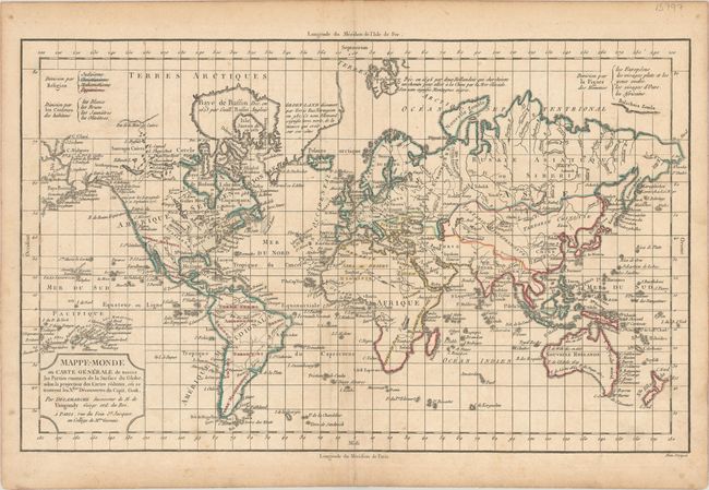
Subject: World

Period: 1800 (circa)

Publication:

Color: Hand Color

Size:
15.6 x 9.6 inches
39.6 x 24.4 cm
Download High Resolution Image
(or just click on image to launch the Zoom viewer)

This thematic map was created to show how the world was divided by either religion, skin color, or facial features, depending on how the map was colored. This example is colored to show the world divided by religion: Judaism, Christianity, Paganism, and Islam. Considering the scale, there is good detail of major place names, watershed, and islands of the world. The map has been updated to illustrate the recent discoveries of Cook, La Perouse, Vancouver, and Mackenzie. Notations in the Arctic discuss Erik the Red's discovery of Greenland and Barentz's discovery of Spitsbergen in 1596, and there is good detail of the islands of the Pacific. Title cartouche notes that Delamarche is the successor to Robert de Vaugondy. Engraved by Dien.

References:

Condition: B+

Minor toning and a few spots of foxing.

Estimate: $120 - $150

Sold for: $90

Closed on 11/13/2019

Archived