Catalog Archive
Auction 174, Lot 662

"Afbeeldinge van de Veertich-Iaarige Reyse der Kinderen Israels uyt Egypten door de Roode Zee en de Woestyne tot in't Beloofde Landt Canaan", Danckerts/Wetstein
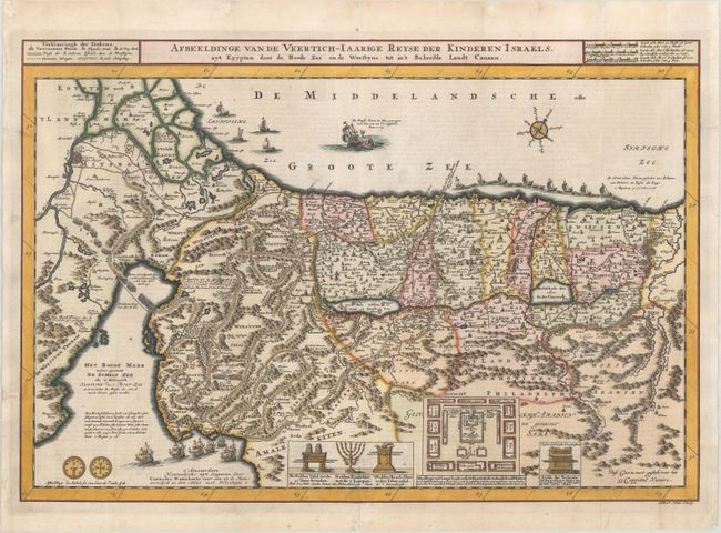
Subject: Holy Land

Period: 1718 (published)

Publication:

Color: Hand Color

Size:
19.9 x 13.6 inches
50.5 x 34.5 cm
Download High Resolution Image
(or just click on image to launch the Zoom viewer)

Attractive and decorative map of the Holy Land divided into the twelve Tribes of Israel, depicting the Exodus from Egypt and the wanderings of the Children of Israel. The lower part of the map is elaborately engraved with a scene of the encampment of the Children of Israel and religious sacraments, including the Ark of the Covenant. The map is further decorated with a scale depiction of a shekel and a convoy of ships bringing cedar for the building of Solomon's Temple, while Jonah and the whale prepare to meet. The map was drawn and engraved by Albert Schut and first published by Danckerts, circa 1710. This is the first state, with Dutch text on verso.

References: Poortman & Augusteijn #161.

Condition: A

A sharp impression on a bright sheet, issued folding with professional repairs to several minor fold separations and a couple of marginal tears.

Estimate: $240 - $300

Unsold

Closed on 9/11/2019

Archived