Catalog Archive
Auction 174, Lot 469
"Plan of the City of Aire and of Fort St. Francis with a View of St. Venant / Aire A Very Strong City and Castle in the Low Countries, in the Earldom of Artois, Taken by the Allies in 1710, but Restor'd to the French by the Treaty of Utrecht", Tindal, Nicholas
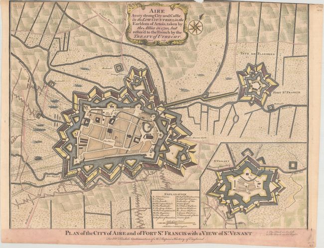
Subject: Aire, France
Period: 1745 (circa)
Publication: Mr. Rapin's History of England
Color: Hand Color
Size:
18.4 x 14 inches
46.7 x 35.6 cm
Download High Resolution Image
(or just click on image to launch the Zoom viewer)
(or just click on image to launch the Zoom viewer)