Catalog Archive
Auction 174, Lot 343

"Brasilia", Montanus/Ogilby
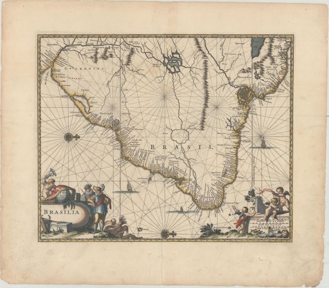
Subject: Brazil

Period: 1671 (published)

Publication: America…

Color: Hand Color

Size:
13.9 x 11.3 inches
35.3 x 28.7 cm
Download High Resolution Image
(or just click on image to launch the Zoom viewer)

Montanus' work was perhaps the greatest illustrated book on the New World produced in the seventeenth century. It contained over one hundred beautifully engraved plates, views, and maps of North and South America. The plates vividly depict forts, festivals, occupations, Dutch fleets, battles, religious rites, and customs of the native inhabitants. This important work was translated into German by Olivier Dapper, and into English by John Ogilby. Several of the plates were later acquired by Pierre Vander Aa.

Excellent map of the eastern part of Brazil based on the cartography of Hessel Gerritsz and an earlier map by Blaeu. There is extensive detail in the coastal regions with the interior left largely blank except for some conjectural river systems, including the mythical Parime Lago in Guiana and Xarayes Lago in Brazil. The Linea Aequinoctialis is prominently shown dividing the Spanish and Portuguese colonial claims. The map is richly embellished with rhumb lines, compass roses, and sailing ships. European traders, Indians, and putti surround the title and scale of miles cartouches.

References:

Condition: A

A nice impression with faint offsetting. There are some edge tears and soiling confined to the blank margins.

Estimate: $350 - $425

Unsold

Closed on 9/11/2019

Archived