Catalog Archive
Auction 174, Lot 337

"Carte Reduite des Costes de la Guyane Depuis la Riviere d'Orenoque Jusqu'au Cap de Nord, a l'Entree de la Riviere des Amazones", Bellin, Jacques Nicolas

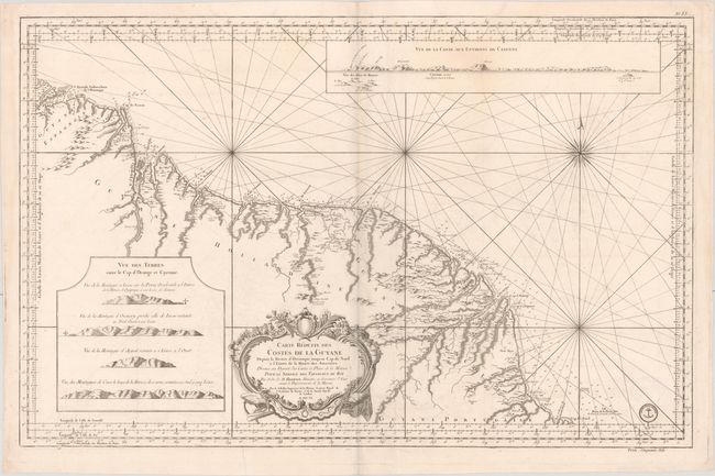
Subject: Guyana, Suriname, French Guiana

Period: 1760 (dated)

Publication:

Color: Black & White

Size:
34.6 x 22.1 inches
87.9 x 56.1 cm
Download High Resolution Image
(or just click on image to launch the Zoom viewer)

This is a magnificent, large-scale map of the coast of Guyana. It covers the region from the mouth of the Orinoco to Cabo Norte with the regions noted as being Spanish, Dutch, French and Portuguese possessions. The detail extends to include a good portion of the major rivers with the locations of forts, missions, colonial settlements, and Indian villages. Inset at top is a coastal approach view of Cayenne and inset at lower left are four other coastal views of the entrance to Cabo Orange and Cayenne. In addition to the informational nature of the chart, it is ornamented with a fine compass rose and decorative title cartouche. The engraved seal of the Depot de la Marine appears at bottom right, with the price "Cinquante Sols" just below the neatline.

References:

Condition: B+

An overall bright example with light soiling, some minor creasing, and a few small abrasions at bottom right. There are separations along the plate mark in the bottom blank margin that have been archivally repaired.

Estimate: $275 - $350

Unsold

Closed on 9/11/2019

Archived