Catalog Archive
Auction 174, Lot 324

"Amerique Meridionale Divisee en ses Principales Parties ou sont Distingues les uns des Autres les Estats Suivant qu'ils Appartienent Presentement, aux Francois, Castillans, Portugais, Hollandois &...", Sanson/Jaillot

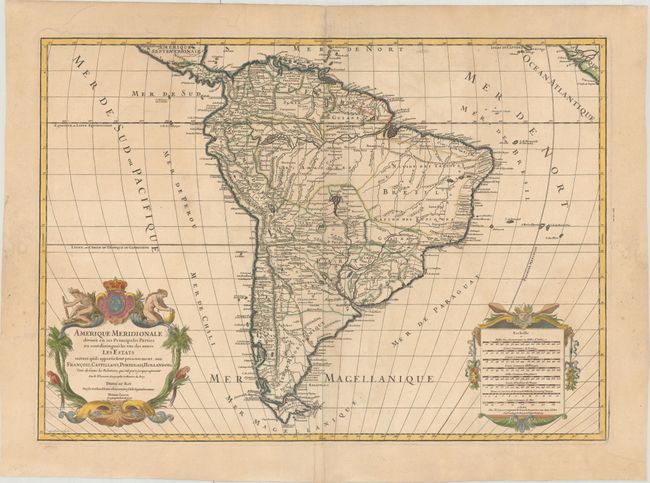
Subject: South America

Period: 1719 (dated)

Publication: L'Atlas Francais

Color: Hand Color

Size:
25.5 x 18 inches
64.8 x 45.7 cm
Download High Resolution Image
(or just click on image to launch the Zoom viewer)

This is a handsome and large map of the continent decorated with elaborate title and scale of miles cartouches balancing the lower portion of the map. The continent is divided into the French, Spanish, Portuguese and Dutch possessions. The fourteen coastal Capitaineries created by the Portuguese are outlined in Brazil. The course of the Amazon is delineated in a fairly accurate manner, yet it shows the river's source in a fascinating, interlacing maze of waterways. The Rio Paraguay erroneously begins at a lake named Xarayes in the middle of Brazil. The title cartouche features two natives and tropical birds, engraved by C. Simonneau. The map was engraved by Louis Cordier. This edition was published by Alexis-Hubert Jaillot's son, Bernard Jean-Hyacinthe, who inherited the business after his father's death in 1712.

References: Pastoureau, Jaillot II G [6].

Condition: B+

A nice impression on sturdy paper with wide margins and the watermark of a Maltese cross encircled with rosary beads. There is light soiling and a couple of printer's creases.

Estimate: $400 - $500

Sold for: $250

Closed on 9/11/2019

Archived