Catalog Archive
Auction 174, Lot 313

"Carte de la Gonave Dressee sur les Operations Geometriques Faites en 1787...", Depot de la Marine

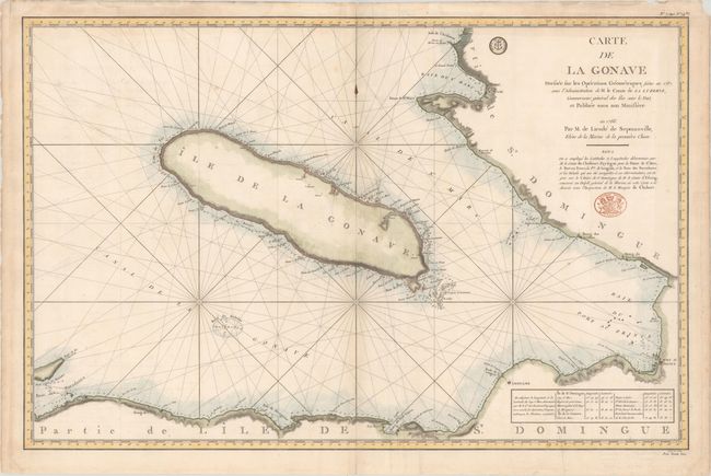
Subject: Gonave Island, Haiti

Period: 1788 (dated)

Publication: Hydrographie Francoise...

Color: Hand Color

Size:
34.8 x 22.6 inches
88.4 x 57.4 cm
Download High Resolution Image
(or just click on image to launch the Zoom viewer)

Large-scale chart of the Gulf and island of Gonave and the southwest coast of Haiti, including Port-au-Prince. Filled with rhumb lines, soundings, navigational hazards, anchorages, etc. Originally issued in 1788, there were many editions with updates to 1880. The engraved seal of the Depot de la Marine appears to the left of the title, and the price is below the neatline at right: Prix Trente Sous. Engraved by Croisey.

References:

Condition: B+

On sturdy paper with the watermark of "T Dupuy Auvergne," light soiling, and extraneous creasing. There are archival repairs to a short separation along the centerfold and to two 3" tears adjacent to the centerfold. Below the title is a stamp from the Military Depot.

Estimate: $240 - $300

Sold for: $130

Closed on 9/11/2019

Archived