Catalog Archive
Auction 174, Lot 253

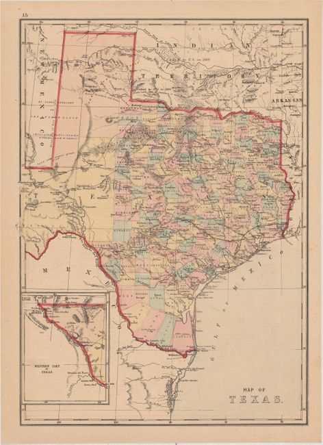
"Map of Texas", Williams, J. David

Subject: Texas

Period: 1875 (circa)

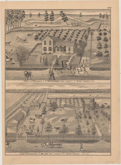
Publication: Historical Atlas of the World … Henry County, Ohio

Color: Hand Color

Size:
12.4 x 17.1 inches
31.5 x 43.4 cm
Download High Resolution Image
(or just click on image to launch the Zoom viewer)

This is an interesting map of Texas that uses longitudinal projection lines, which increase in width the further south one goes, to more accurately reflect the curvature of the earth and distance between degrees of longitude. It includes superb detail of trails, ponds, springs, forts, and railroads along with additional information on the region's natural resources (gypsum, salt, arable land, timber, sand, course grass, and forests labeled Mesquite Openings). County development extends beyond the 100th meridian, with the large El Paso, Presidio, and Young territories still occupying the west. The "Western Part of Texas" is shown in an inset on the same scale as the main map. Published by Hardesty & Co., in Historical Atlas of the World…Henry County, Ohio with the verso containing two farm views.

References:

Condition: A

There is a faint extraneous crease at bottom right, otherwise fine.

Estimate: $220 - $250

Sold for: $220

Closed on 9/11/2019

Archived