Catalog Archive
Auction 174, Lot 233
"Map of the Progress of His Majesty's Armies in New York, During the Late Campaign Illustrating the Accounts Publish'd in the London Gazette", Anon.
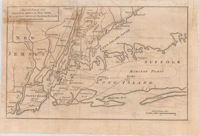
Subject: Colonial Southern New York
Period: 1776 (circa)
Publication: Gentleman's Magazine
Color: Black & White
Size:
12.4 x 7.8 inches
31.5 x 19.8 cm
Download High Resolution Image
(or just click on image to launch the Zoom viewer)
(or just click on image to launch the Zoom viewer)