Catalog Archive
Auction 174, Lot 179

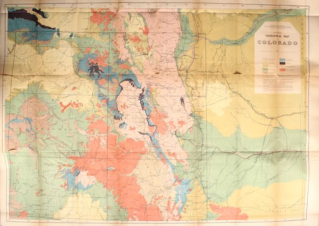
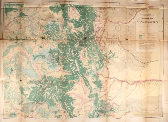
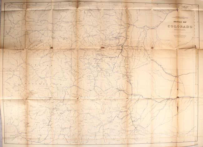
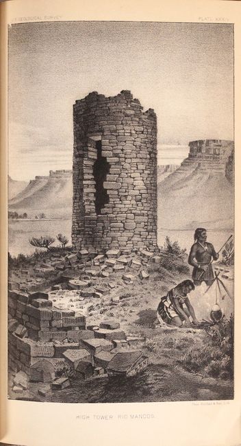
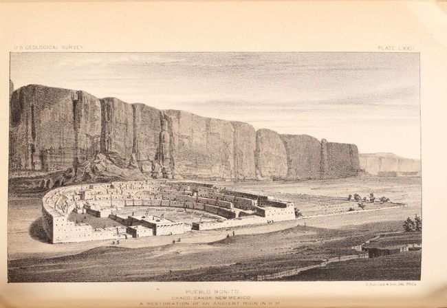
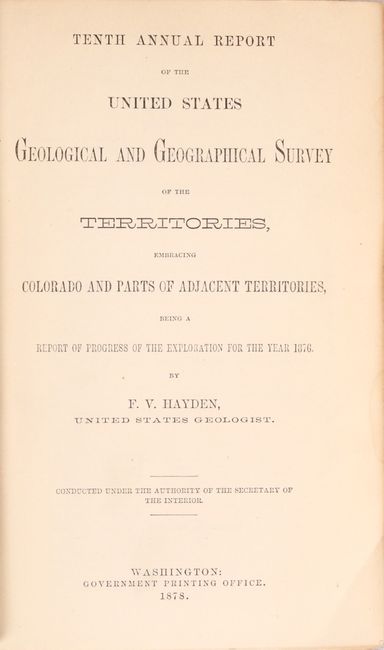
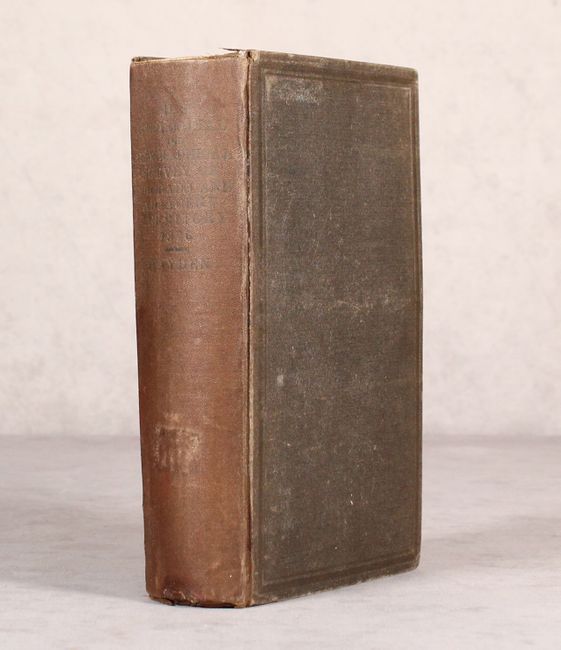
"Tenth Annual Report of the United States Geological and Geographical Survey of the Territories, Embracing Colorado and Parts of Adjacent Territories...", Hayden, Ferdinand Vandeveer

Subject: Colorado & New Mexico

Period: 1878 (published)

Publication:

Color: Black & White

Size:
5.9 x 9.3 inches
15 x 23.6 cm
Download High Resolution Image
(or just click on image to launch the Zoom viewer)

This classic work documents the journeys of Hayden's field parties through parts of Colorado and New Mexico in 1876. It was the most richly illustrated annual report issued to date including, for the first time, tinted lithographs and true chromolithographic maps. The three large, color folding maps (35x25") found at the end of the volume include:

General Geological Map of Colorado
Economic Map of Colorado
Drainage Map of Colorado
The General Geological Map of Colorado was the first published geological map of Colorado. Each of these maps also correspond to sheets included in Hayden's famous Geological and Geographical Atlas of Colorado published in 1877 and 1881. These maps are considered the best mapping of the period and laid the foundation for the mapping of Colorado.

In addition to Hayden's report on field activities, the volume contains the geological reports of C. A. White, F. M. Endlich, A. C. Peale, and W. H. Holmes; the topographic reports of A. D. Wilson, Henry Gannett, George Chittenden, and Gustavus Bechler; archeological and ethnologic reports of W. H. Jackson and W. J. Hoffman; and paleontological and zoological reports by Leo Lesquereux and A. S. Packard. Many illustrations of scenery, artifacts, ruins, etc. drawn and signed in print by Holmes and Jackson.

The geological reports focus on northwestern and southwestern Colorado (Yampa and White River areas), the Grand River area (upper Colorado River), the Dolores and San Miguel River areas, Paradox Valley, and parts of southeastern Utah. Some sections contain large folded maps that furnish the first detailed geological mapping of these areas. The report also gives a catalogue of over 230 Colorado minerals with notations of localities and mines found, some with chemical analyses.

The archeological section provides much detailed information and illustrations on ruins and pueblos in southwestern Colorado, northwestern NM, and northeastern Arizona, including such well known sites as Mesa Verde, Chaco Canyon, and Canyon de Chelly. The papers are accompanied by the large folding "Map of the Region Occupied by the Ancient Ruins in Southern Colorado, Utah & Northern New Mexico and Arizona, also Showing the Location of Most of the Modern Pueblos".

First edition. Octavo, 546 pages, including 9 black & white text illustrations, 75 (of 76) b&w and sepia tinted plates, and the three large folding maps. Lacking only plate LXXVIII, which does not appear to have been issued in this example. Hardbound in original brown cloth with title on spine.

References:

Condition: B

The colorful maps each have light toning especially pronounced along the folds, a number of short fold separations, and binding tears at left. The drainage map has more separations than the other two, with a few small areas of loss. Text is good with pleasant light toning and some minor extraneous creasing. The hinge is starting, the spine is sunned, and the covers have light wear with bumped edges.

Estimate: $200 - $230

Sold for: $150

Closed on 9/11/2019

Archived