Catalog Archive
Auction 173, Lot 85

NO RESERVE

"A Correct Map of North America",

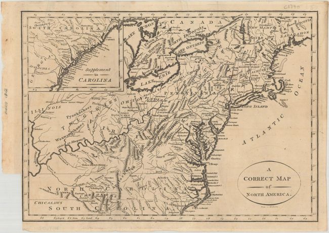
Subject: Eastern United States

Period: 1812 (circa)

Publication: A New Historical and Commercial System of Geography

Color: Black & White

Size:
11.4 x 8.1 inches
29 x 20.6 cm
Download High Resolution Image
(or just click on image to launch the Zoom viewer)

This uncommon map stretches from Georgia to Maine (Sagadahok) and is based on Robert de Vaugondy's Partie de l'Amérique Septentrionale, qui Comprend le Cours de l'Ohio, la Nlle. Angleterre, la Nlle York, le New Jersey, la Pensylvanie, le Maryland, la Virginie, la Caroline. The Carolinas and Virginia extend to the Mississippi River. Pennsylvania is enlarged and shown taking in part of New York, which in turn encompasses all of New Jersey. New England consists of only Massachusetts and New Hampshire. Lakes Huron, Ontario, and Erie appear in a largely accurate configuration. A large inset titled "Supplement to Carolina" features the remainder of South Carolina and parts of Georgia. Filled with Indian names. Given that the map's source was 45 years old at the time of publication, this map is strangely out-of-date. Engraved by Paas.

References: cf. McCorkle #800.2.

Condition: B+

Issued folding on "E&S 1812" watermarked paper with some faint offsetting and a short binding trim at bottom left.

Estimate: $220 - $250

Sold for: $55

Closed on 6/5/2019

Archived