Catalog Archive
Auction 173, Lot 77

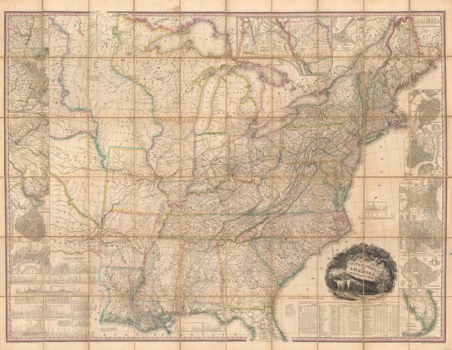
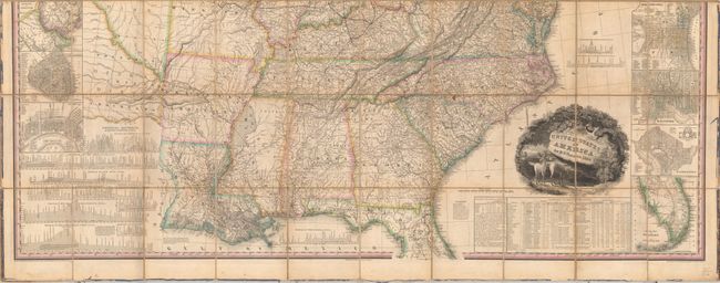
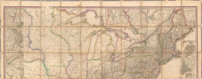
First Edition of Tanner's Important Map of the United States

"United States of America [with] Memoir on the Recent Surveys, Observations, and Internal Improvements, in the United States... [and] Memoir on the Recent Surveys ... Second Edition", Tanner, Henry Schenck

Subject: United States

Period: 1829 (dated)

Publication:

Color: Hand Color

Size:
61 x 45.7 inches
154.9 x 116.1 cm
Download High Resolution Image
(or just click on image to launch the Zoom viewer)

This is the first edition of Tanner's important and detailed map of the eastern two-thirds of the United States. David Rumsey describes it as " one of best early large maps of the United States and the premier map for its period, without equal until Mitchell produced the first edition of his Reference and Distance Map of the United States in 1834." The map was well received by the public and went through numerous editions from 1829-1844. Cartographically, it covers the region from the eastern seaboard to the Dakotas and Indian Territory with longitude marked from Washington DC (much to the dismay of European mapmakers). To the north and west of Missouri are Indian districts including Huron, Osage, and Ozark with numerous Indian tribes located throughout. Indian trails, Indian villages, and military forts are also located in these regions with some useful notations including "Here the bands of Sioux meet every Spring to trade with each other and with the white Traders." In the organized areas of the country, distances on primary wagon roads are shown between settlements. Tanner notes in his Memoir that including the mileage information caused him to take twice as long in completing the map. Surrounding the map are a series of insets including fourteen cities, the southern part of Florida, Oregon and Mandan Districts, along with numerous profiles and statistical tables. The map is further decorated by a title cartouche featuring a forest scene with deer and farmland in the background. Dissected into sixty panels and backed with original linen.

The map is complimented by both the first and second editions of Tanner's Memoir on the Recent Surveys. 108 pages each and nearly identical. The map case and two volumes are all quarter calf with tips over marbled boards.

References: Phillips (Maps) p. 885; Howes #T-28; Ristow pp. 198-199; Streeter #3835; Sabin #94318; Schwartz & Ehrenberg p. 253.

Condition: B+

An attractive map with some light toning and minor foxing that is predominantly along the fold lines. There are some light stains, minor abrasions, and a small area of loss in North Carolina. The linen has small separations in several areas (primarily at fold intersections) but does not impact the map image. Map case boards are moderately worn and separated as the spine has perished. Text volumes are internally good to very good with light toning and scattered foxing. Externally there is only light wear with the front board of the second edition detached and not present.

Estimate: $9,500 - $12,000

Sold for: $7,000

Closed on 6/5/2019

Archived