Catalog Archive
Auction 173, Lot 442

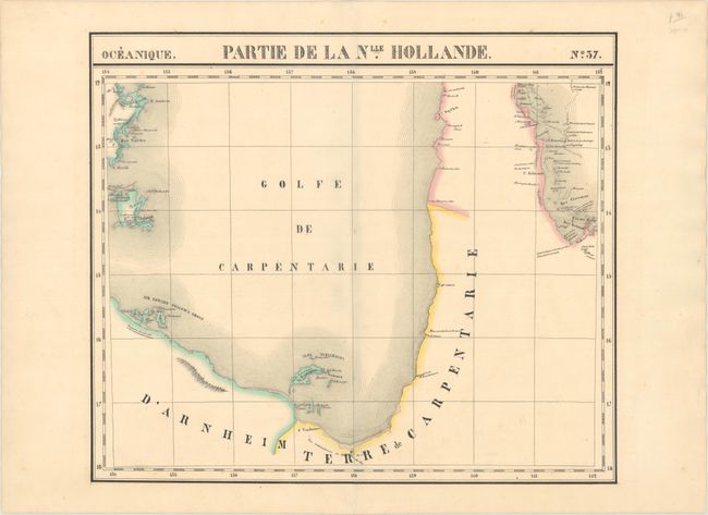
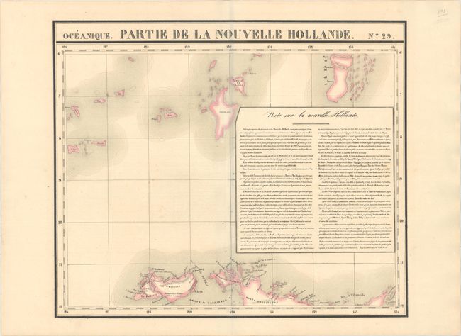
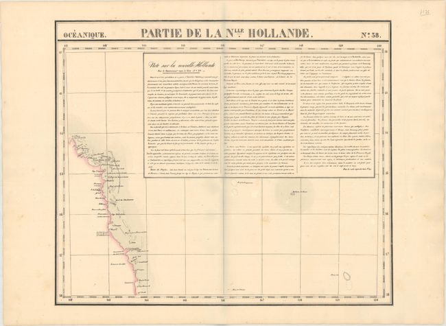
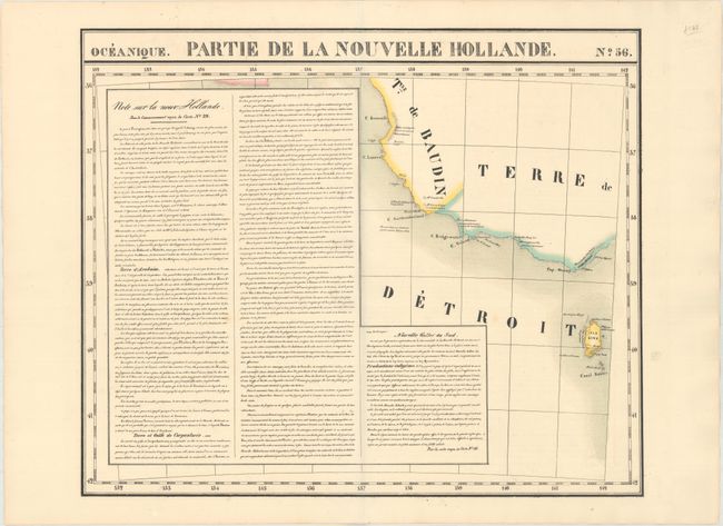
"[Lot of 4] Oceanique. Partie de la Nlle. Hollande. No. 37 [and] No. 29 [and] No. 38 [and] No. 56", Vandermaelen, Philippe Marie Guillaume

Subject: Australia

Period: 1825-27 (published)

Publication: Atlas Universel

Color: Hand Color

Size:
21.4 x 18.5 inches
54.4 x 47 cm
Download High Resolution Image
(or just click on image to launch the Zoom viewer)

Vandermaelen was the son of a wealthy industrialist who abandoned his father's business to follow a career in cartography. His goal was to produce the first atlas ever published in which every map was drawn on the same projection and to the same scale (1: 1,641,836), with each map covering an area of approximately 20 degrees of longitude (from Paris) and 6 degrees of latitude. Because of the consistent scale and projection, the maps could be joined together to form a huge globe that would measure over 25 feet in diameter. Vandermaelen had the only known globe constructed from his maps, requiring a special room for its display. It was also the first lithographic atlas ever published. There was one edition of the atlas, published in 1825-27, and the subscription list shows that only 810 copies were sold. Koeman called his Atlas Universel, "One of the most remarkable world atlases ever made. Far ahead of its time."

This lot features 4 uncommon maps of Australia's coast from Vandermaelen's landmark atlas. No. 37 covers the Gulf of Carpentaria. No. 29 spans from Melville Island north to show some of the Tanimbar Islands. It also includes a box of French text. No. 38 zooms in on the northeastern coast of Queensland, extending from Cape Melville to Dunk Island, with descriptive French text. No. 56 depicts southern Victoria and King Island and also includes French text.

References:

Condition: A

Original outline color with wide margins. There are minor, unobtrusive spots and a hint of offsetting.

Estimate: $400 - $500

Unsold

Closed on 6/5/2019

Archived