Catalog Archive
Auction 173, Lot 422

"Particular Draughts of Some of the Chief African Islands in the Mediterranean, as Also in the Atlantic and Ethiopic Oceans", Bowen, Emanuel

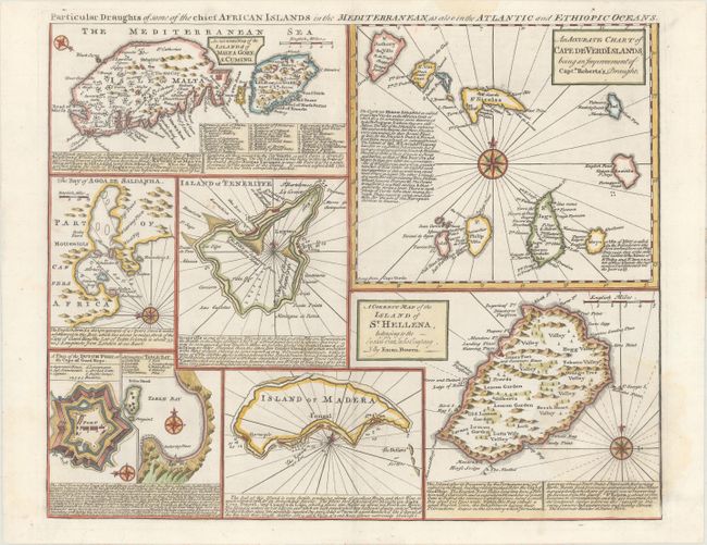
Subject: African Islands; Malta

Period: 1766 (published)

Publication: The Maps and Charts to the Modern Part of the Universal History...

Color: Hand Color

Size:
16.7 x 13.5 inches
42.4 x 34.3 cm
Download High Resolution Image
(or just click on image to launch the Zoom viewer)

This sheet includes 8 separate small maps, primarily focused on islands around, or a part of, Africa. The maps include: An Accurate Map of the Islands of Malta Goze & Cuming; An Accurate Chart of Cape de Verd Islands...; The Bay of Agoa de Saldanha; Island of Teneriffe; A Plan of the Dutch Fort at the Cape of Good Hope; A Draught of Table Bay; Island of Madera; and A Correct Map of the Island of St. Hellena... Each map features place names, topographical information, a compass rose, and descriptive English text.

References: Norwich #338; Shirley (BL Atlases) T.BOW-2d #35.

Condition: A

A crisp impression on a bright sheet with a faint dampstain at bottom right.

Estimate: $220 - $250

Sold for: $190

Closed on 6/5/2019

Archived