Catalog Archive
Auction 173, Lot 34

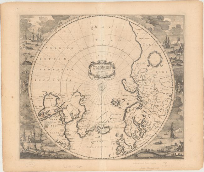
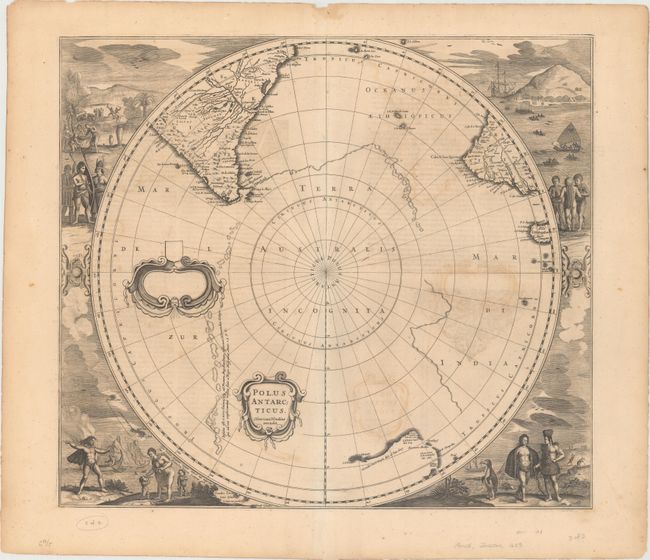
Magnificent Polar Maps Surrounded by Engraved Scenes

"[Lot of 2] Poli Arctici, et Circumiacentium Terrarum Descriptio Novissima [and] Polus Antarcticus", Hondius, Henricus

Subject: Polar

Period: 1639 (circa)

Publication: Nouveau Theatre du Monde...

Color: Black & White

Size:
19.4 x 17 inches
49.3 x 43.2 cm
Download High Resolution Image
(or just click on image to launch the Zoom viewer)

A splendid pair of maps depicting the poles:

Poli Arctici, et Circumiacentium Terrarum Descriptio Novissima. Hondius' important map is one of the most decorative maps of the North Pole. It replaced Mercator's map in the Mercator/Hondius atlases in 1636, and incorporated much of the knowledge gained by the English in their search for a Northwest Passage to Asia. The cartography is based on Henry Briggs' depiction of Hudson Bay, showing a pair of bays in the bottom of Hudson Bay named Iames his Bay and The Great Bay of God's Deliverance. There are more names based on Hudson's explorations, including the note of Ne Ultra in an inlet at the top of the bay indicating that they could go no further there. There are several Dutch names in Labrador, many appearing for the first time on this map. The fascinating whaling scenes that surround the map also depict Dutch activity in the region. There are many types of ship and boats shown, as well as whales, seals and cormorants. Burden's third state (Kershaw's second state); the first with the whaling scenes. References: Van der Krogt (Vol. I) #0020:1B; Burden #246; Kershaw #99.

Polus Antarcticus. This early map of the South Pole is considered one of the earliest realistic maps of the Antarctic continent, which is partially delineated in a combination of coastline and strings of islands noted as first discovered by Magellan. The circular map also shows parts of South America, Africa and Madagascar with the incomplete coastline of Australia. When first published in 1637, this was the first printed map to show the discovery of Peter Nuyts Land and was the best map of Australia prior to Tasman's discoveries. Other early Dutch explorations in the region are also noted. The map is surrounded by fabulous engravings of natives and early explorers. Further decorated by a strapwork title cartouche and a blank dedication cartouche. References: Van der Krogt (Vol. I) #0030:1.1; Tooley (Australia) p. 198, #7; Tooley (MCC-2) #20.

French text on verso, published between 1639-49.

References:

Condition: B+

Crisp impressions with light toning, light offsetting, and scattered foxing.

Estimate: $3,000 - $4,000

Unsold

Closed on 6/5/2019

Archived