Catalog Archive
Auction 173, Lot 152

"Plat of Cherokee Lands. Ind: Ter: Surveyed Under Instructions from Isaac McCoy", McCoy, Isaac
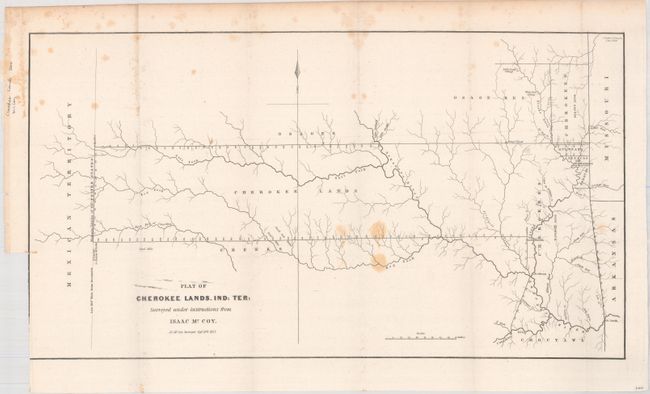
Subject: Oklahoma

Period: 1837 (dated)

Publication: Sen. Doc. 120, 25th Congress, 2nd Session

Color: Black & White

Size:
19.7 x 10.8 inches
50 x 27.4 cm
Download High Resolution Image
(or just click on image to launch the Zoom viewer)

This is one of the earliest printed maps to depict present-day Oklahoma in any detail. It shows a track of land that extends from the borders of Missouri and Arkansas to the "Western Limits of the United States" (100° W. Longitude from Greenwich). The map was drawn at the conclusion of the "Trail of Tears" and shows the furthest extent of the land reserved to the Cherokees, as well as several other reservations (part of which are in what is present-day Kansas). A terrific and early Indian Territory map surveyed by J.C. McCoy under Isaac McCoy's direction, dated in the plate Sept. 20th, 1837.

References: Clausen & Friis #188.

Condition: B+

Issued folding with light scattered foxing. There is a binding tear at lower left and an associated short binding tear that has been closed on verso with archival tape.

Estimate: $180 - $220

Sold for: $130

Closed on 6/5/2019

Archived