Catalog Archive
Auction 173, Lot 139

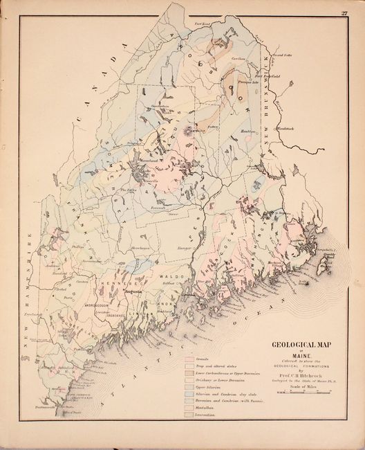
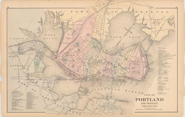
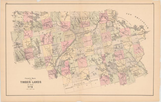
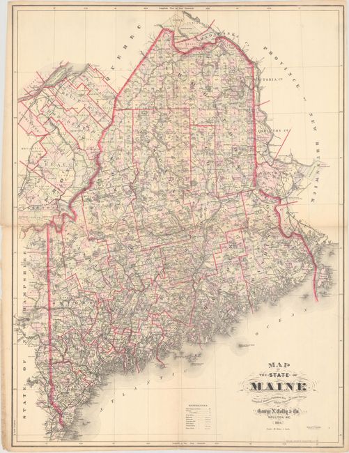
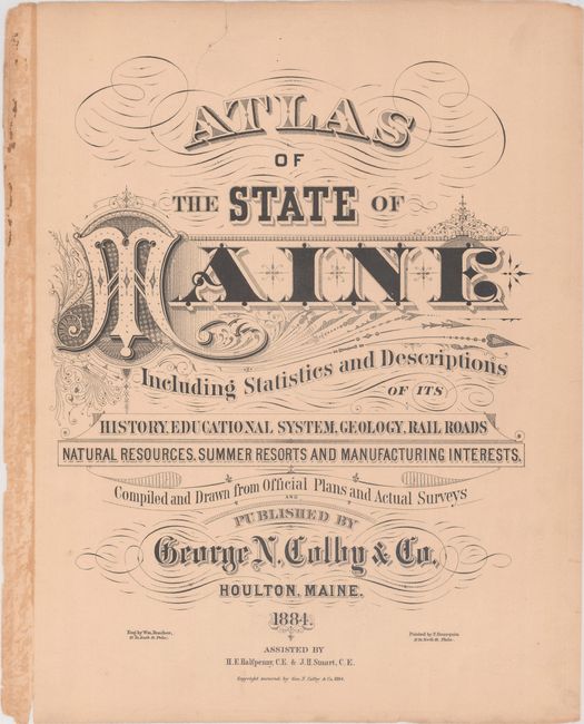
"[Disbound] Atlas of the State of Maine Including Statistics and Descriptions of Its History, Educational System, Geology, Rail Roads Natural Resources, Summer Resorts and Manufacturing Interests...", Colby, George N.

Subject: Maine

Period: 1884 (published)

Publication:

Color: Hand Color

Size:
14.2 x 17.3 inches
36.1 x 43.9 cm
Download High Resolution Image
(or just click on image to launch the Zoom viewer)

This disbound atlas of the state contains a wealth of information including 32 single-page, 13 double-page, and one folding map of the state (missing are the double-page maps of Piscataquis County and Gray's map of the world). Of particular interest are Hitchcock's Geological Map of Maine, a nice double-page map of Portland, and Gray's New Map of the United States. The frontispiece to the volume is Colby's large folding map of the state (24.7 x 32.9") that is meticulously hand-colored by township and richly illustrates roads, railroads, projected railroads, post offices, and more. Includes 25 pages of descriptive text and a business directory at the end of the volume. 116 pages, hardbound in quarter leather and tips over brown cloth boards with gilt title on the front cover.

References:

Condition: B+

Condition code is for the maps, which are generally very good with uniform pleasant light toning and occasional edge chips confined to the far blank margins. The large folding map of the state has a number of short fold separations and one tear at left. Text block is very loose with a number of separated pages, and both covers are moderately worn and detached. Given the condition of the binding, this lot should be considered a collection of loose maps. Maps (B+), Binding (C).

Estimate: $220 - $250

Sold for: $120

Closed on 6/5/2019

Archived