Catalog Archive
Auction 173, Lot 136

"Molokai", Hawaii Territorial Surveys

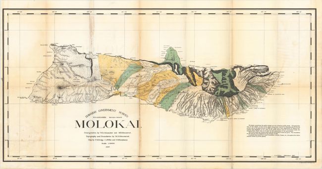
Subject: Moloka'i, Hawaii

Period: 1897 (dated)

Publication:

Color: Printed Color

Size:
34 x 16.8 inches
86.4 x 42.7 cm
Download High Resolution Image
(or just click on image to launch the Zoom viewer)

This is the first edition of the smaller version of the colorful lithographed map produced by W.D. Alexander, the Surveyor-General. The very detailed map delineates the topography, watershed, villages, land grants, coastal detail, lava flows, and property owners. At the turn of the century numerous valleys supported cattle ranches. Triangulation, boundaries, and topography by Alexander and M.D. Monsarrat. The map was drawn by F.S. Dodge, C.J. Willis, and S.M. Kanakanui. An early and fascinating map of this beautiful island.

References:

Condition: B

Issued folding with light toning along the folds, light damp stains, and several fold separations, the longest of which measures 5".

Estimate: $180 - $210

Unsold

Closed on 6/5/2019

Archived