Catalog Archive
Auction 173, Lot 108

"Cours du Mississipi Comprenant la Louisiane, les 2 Florides, une Partie des Etats-Unis et Pays Adjacents", Poirson, Jean Baptiste

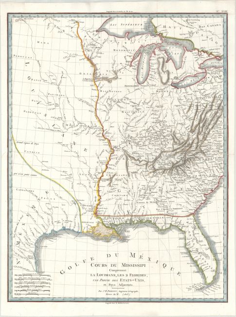
Subject: Central United States

Period: 1803 (dated)

Publication: Statistique Generale et Particulare de la France et ses Colonies…

Color: Hand Color

Size:
16.3 x 21.3 inches
41.4 x 54.1 cm
Download High Resolution Image
(or just click on image to launch the Zoom viewer)

This rare map focuses on the course of the Mississippi River and the regions surrounding it, including the Louisiana Purchase, which was made the same year this map was published. There is a stark contrast between the area east of the Mississippi, which is filled with details of rivers, towns, forts, and Indian Nations, and the area to the west, which includes limited information. A note at far left states "large area of the country that is unknown." Within Louisiana, the Missouri and Arkansas Rivers are beginning to take shape, but there is still no sign of the Platte River. The Spanish influence in North America is still apparent in Florida, which is divided into East and West, and Tecas part of Nau. Mexique. Published in Etienne Herbin De Halle's Statistique Generale et Particulare de la France et ses Colonies…

References: Wheat (TMW) #257.

Condition: A

A bright sheet, issued folding, with the watermark "G [heart] Fenerol Ambert" and professional repairs to a couple of minor fold separations.

Estimate: $400 - $500

Sold for: $550

Closed on 6/5/2019

Archived