Catalog Archive
Auction 172, Lot 96

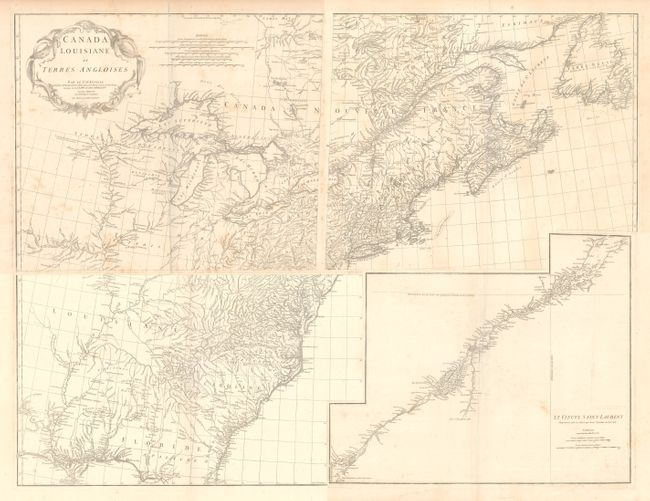
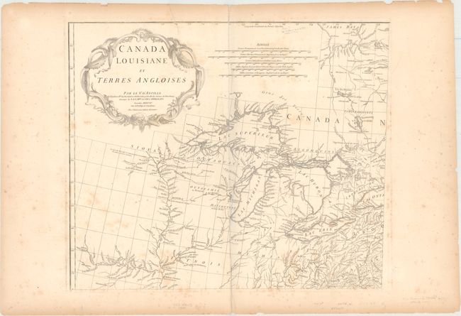
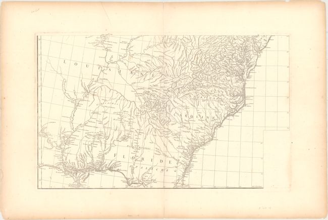
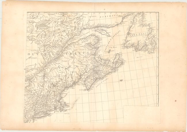
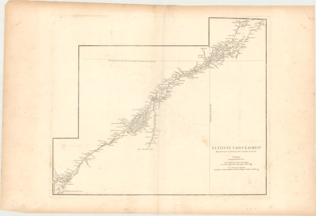
D'Anville's Spectacular Map of Eastern Seaboard

"[On 4 Sheets] Canada Louisiane et Terres Angloises", Anville, Jean Baptiste Bourguignon d'

Subject: Colonial Eastern United States & Canada

Period: 1755 (dated)

Publication: Atlas General

Color: Black & White

Size:
22 x 18.8 inches
55.9 x 47.8 cm
Download High Resolution Image
(or just click on image to launch the Zoom viewer)

This large-scale map covers the region from Labrador to the north of Florida, and from the Mississippi River to the Atlantic Ocean. It also extends to include the southern end of James Bay, and shows all of Great Lakes and the course of the St. Lawrence. The map provides early detail along the lower portion of the Missouri (alternately the "Pekitanoui") and the upper waters of the Mississippi. The Keweenaw peninsula is named as Kiaonan, and Isle Royale is called I. Minong. It is filled with scores of Indian tribes and villages named and located. The map was based in part on Mitchell's famous map of the United States which appeared earlier in the same year. D'Anville developed his version of the map with an emphasis on French influence on the area, omitting Mitchell's legend, references to English factories in the disputed trans-Allegheny area, and drew on French sources for additional details over the Mitchell map. The most obvious change, however, is the large inset of the St. Lawrence River basin ("Le Fleure Saint-Laurent") which appears on a separate sheet. D'Anville's usual, superb cartographic detail is seen throughout. A handsome cartouche designed by Gravelot fills the upper left of the map.

References: Sellers & Van Ee #17; Cumming (SE) #296; Tooley (Amer) p. 316.

Condition: B+

Strong impressions on thick, watermarked paper with wide original margins. There is some light toning that is more prominent along the sheet edges and scattered foxing that is mostly concentrated to the top left sheet containing the title. There are a number of small edge chips and edge tears far from the image. The first image is a composite image - this map is in 4 separate sheets.

Estimate: $1,400 - $1,700

Unsold

Closed on 4/17/2019

Archived