Catalog Archive
Auction 172, Lot 722

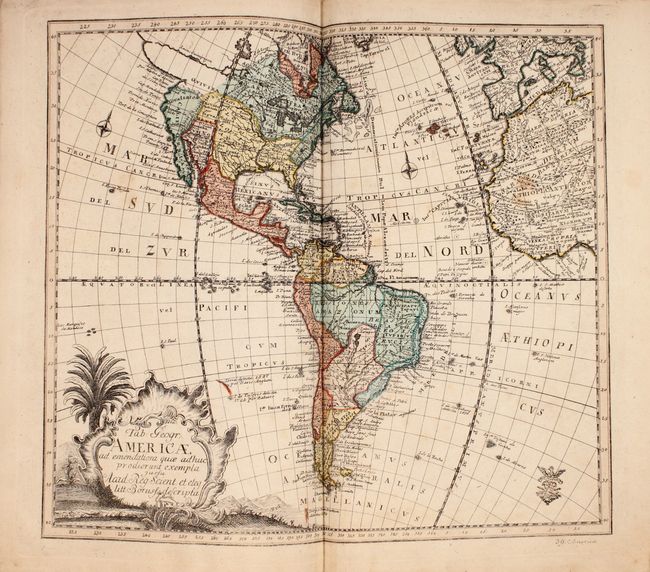
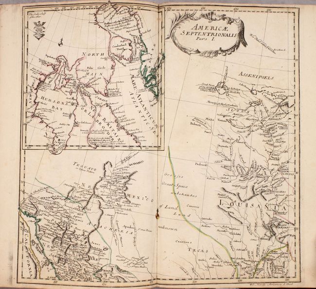
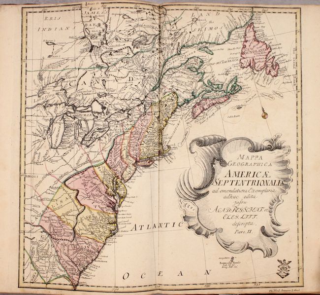
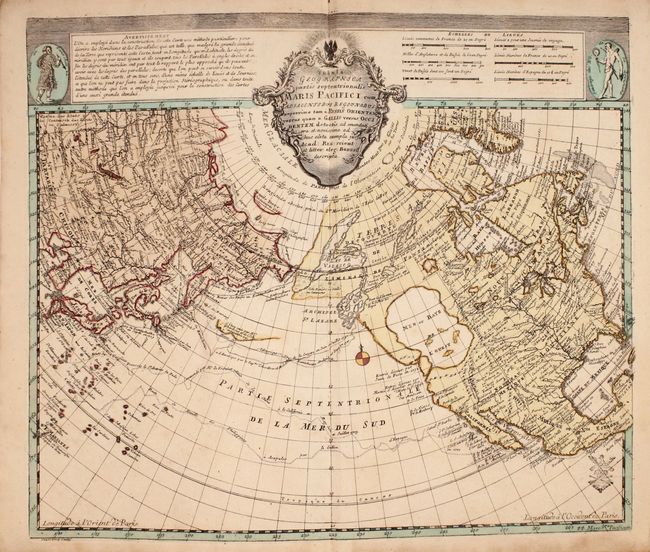
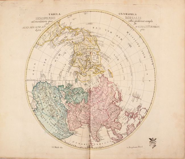
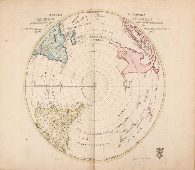
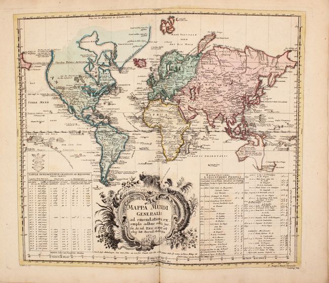
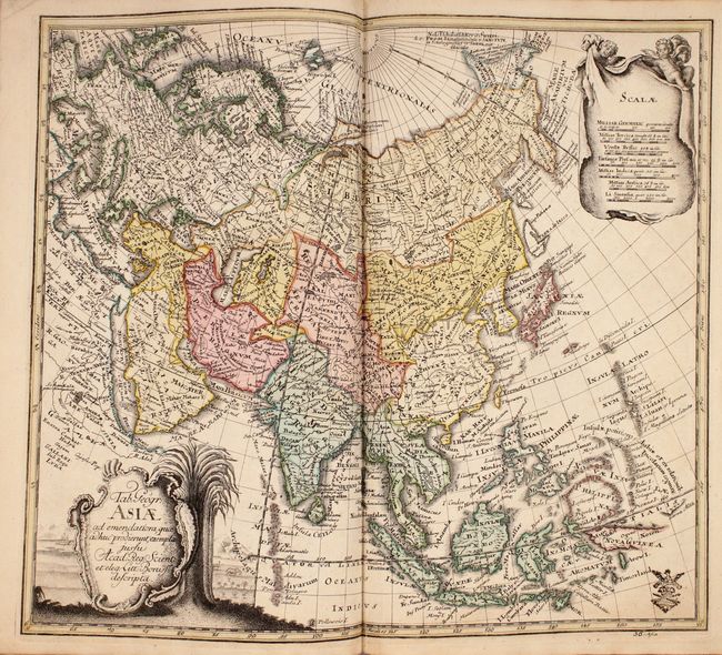
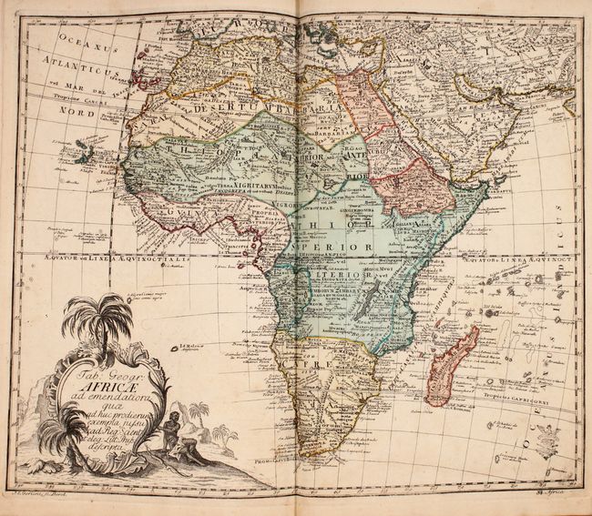
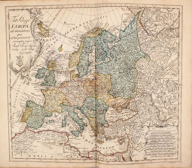
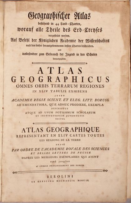
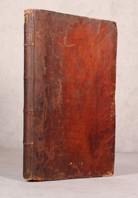
Rare Tri-Lingual Atlas by Euler with 44 Maps in Full Contemporary Color

"Geographischer Atlas Bestehend in 44 Land-Charten.../ Atlas Geographicus... / Atlas Geographique...", Von Euler, Leonhard

Subject: Atlases

Period: 1760 (published)

Publication:

Color: Hand Color

Size:
9.4 x 14.1 inches
23.9 x 35.8 cm
Download High Resolution Image
(or just click on image to launch the Zoom viewer)

This tri-lingual atlas includes 44 maps by Euler and was published by Berolini in Berlin for the Royal Prussian Academy of Sciences. The atlas depicts all regions around the world, and was created for the use of schoolboys. In the preface, Euler explains that the maps represent the most accurate geography of the time as a result of recalculations of latitude and longitude, achieved through Euler's mathematical expertise and the assistance of Johann Christoph Rhode. Euler, a mathematician and academician, worked with Joseph Nicolas Delisle in St. Petersburg and was associated with the preparation of the Atlas Russicus in 1745. He returned to Berlin where his Atlas Geographicus was published for the Royal Prussian Academy of Sciences in 1753, with both the title and preface in Latin and French only. The subsequent edition of 1760 added German to both the title and preface. Each map includes the stamp of the Berlin "Akademie der Wissenschaften" within the title cartouche or discreetly in a corner. Included are 3 maps of the world, North Polar and South Polar projections, 28 maps relating to Europe (including a 4-sheet map of the continent), 4 maps relating to Asia, a map of the continent of Africa, a map of the Western Hemisphere, a 4-sheet map of North America, and a map of the North Pacific Ocean.

There is inconsistency in how North America and Australia are portrayed on different maps within the atlas. On two of the world maps, Australia is correctly depicted with the partial coastlines known at the time, but on the third world map and the South Polar map, conjectural coastlines connect Australia, Tasmania and New Guinea. All three world maps and the map of the western hemisphere show a large western bulge on the northwestern coastline of North America and a possible River of the West, however two other maps (North Polar and North Pacific) show an enormous Sea of the West in the Pacific Northwest. Overall, this rare atlas includes a number of interesting maps that show the extent of European knowledge in the mid-eighteenth century.

Title page, 9-page preface, index, and 44 maps. Folio, hardbound in full contemporary leather with paneling and raised bands on spine.

References:

Condition: B+

The maps are all in full contemporary color with light soiling and minor toning mostly confined to the edges of the sheets. The maps range in condition from A to B+, with more than half in A condition. The first two world maps are more soiled than the remaining maps. There are occasional edge tears on several maps, none of which enter the map images. There is a manuscript page number on the verso of each map. The endpapers and title page have heavy soiling along the edges. The spine is split vertically and the covers are abraided, cracked and beginning to detach.

Estimate: $3,500 - $4,500

Sold for: $5,000

Closed on 4/17/2019

Archived