Catalog Archive
Auction 172, Lot 516

NO RESERVE

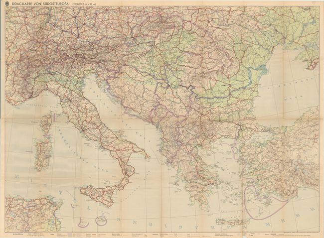
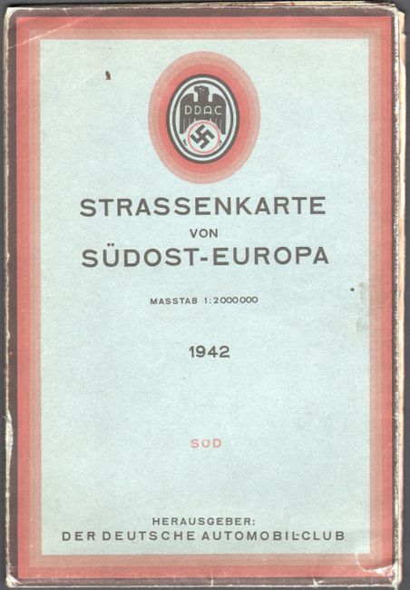
"Strassenkarte von Sudost-Europa",

Subject: Southeastern Europe

Period: 1942 (dated)

Publication:

Color: Printed Color

Size:
45.8 x 33 inches
116.3 x 83.8 cm
Download High Resolution Image
(or just click on image to launch the Zoom viewer)

This road map of southeastern Europe was published by Der Deutsche Automobil-Club (DDAC), which was associated with the National Socialist Motor Corps and replaced all other motorist organizations during the Nazi period. The map extends from Luxembourg in the northwest to nearly Kiev, Ukraine in the northeast, to Tunisia in the southwest and western Turkey in the southeast. Southern Germany and Austria are labeled as the "Deutsches Reich" and the Czech Republic is noted as the Protectorate of Bohemia and Moravia. There is excellent detail of all of the highways, roads, railroads, tunnels, canals, cities of all sizes, and topography of the land. Self folding in blue paper wrappers.

References:

Condition: B+

There is a 2" tear at far left with light toning along the folds and a few minor fold separations. Covers show light soiling and wear.

Estimate: $30 - $50

Sold for: $32

Closed on 4/17/2019

Archived