Catalog Archive
Auction 171, Lot 666

"Carte des Pays Traverses par le Capne. Beerings Depuis la Ville de Tobolsk Jusqu'a Kamtschatka", Anville, Jean Baptiste Bourguignon d'

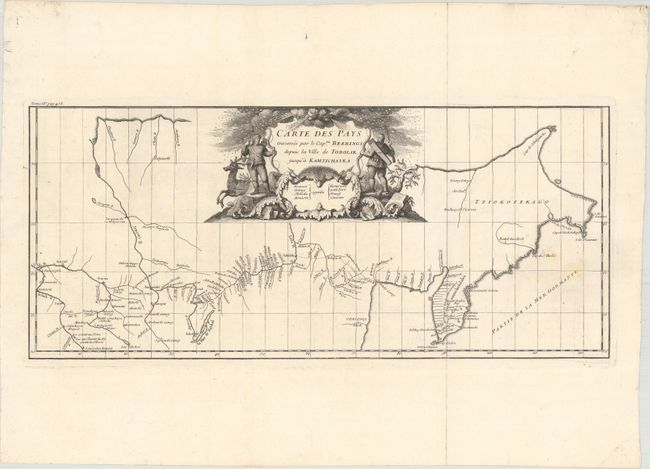
Subject: Russia in Asia

Period: 1737 (circa)

Publication:

Color: Black & White

Size:
21.2 x 9.3 inches
53.8 x 23.6 cm
Download High Resolution Image
(or just click on image to launch the Zoom viewer)

This is the second edition of the first printed map to show Vitus Bering's first expedition to the Siberian Far East. Peter the Great commanded Bering to this region in order to confirm the presence of a strait between Asia and America. While it took Bering two years to reach the Pacific Ocean from St. Petersburg (and five years to return), the expedition was a considerable success in better understanding this remote area. Cartographically, the map covers an area from Tobolsk, the traditional capital of Siberia, to the eastern coast of Russia including Kamchatka. It shows particularly good detail of the river systems and lakes, and identifies a few forts and outposts as well. The map is beautifully decorated by a title cartouche featuring hunters, a reindeer, and windheads amid a snowstorm.

References:

Condition: B+

A dark impression on a bright sheet of watermarked paper with a few faint spots at right.

Estimate: $600 - $750

Unsold

Closed on 2/6/2019

Archived