Catalog Archive
Auction 171, Lot 643

"Tabula Itineraria Patriarcharum Abrahami, Isaaci et Iacobi", Jansson, Jan
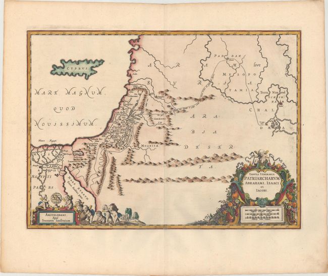
Subject: Holy Land

Period: 1741 (published)

Publication: Description Exacte de l'Univers, ou l'Ancienne Geographie Sacree et Profane

Color: Hand Color

Size:
20.3 x 14.6 inches
51.6 x 37.1 cm
Download High Resolution Image
(or just click on image to launch the Zoom viewer)

A fine decorative map illustrating the travels of Abraham, Isaac, and Jacob, the Patriarchs of the Bible. The map is devoid of detail except in the regions described in the biblical accounts. It covers the region from Cyprus to Iraq and the great city of Babel, and from Egypt to the deserts of Arabia. The decorations represent the bounty of the Promised Land with the title and scale cartouche adorned with a cornucopia of fruit and vegetables, and the imprint cartouche featuring a host of putti harvesting fruit and vegetables. Blank verso, published in Pieter de Hondt's Description Exacte de l'Univers, ou l'Ancienne Geographie Sacree et Profane, a French edition of Georgius Hornius' Accuratissima Orbis Antiqui Delineatio, which included maps from Johannes Jansson's historical atlas and Abraham Ortelius' Parergon.

References: Laor #371; Van der Krogt (Vol. I) #8020H:1.

Condition: A

A sharp impression on a clean, bright sheet with some printer's ink residue at far right and minor toning along the edges of the sheet.

Estimate: $275 - $350

Sold for: $200

Closed on 2/6/2019

Archived