Catalog Archive
Auction 171, Lot 430

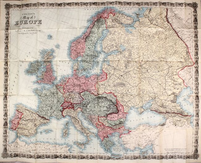
"Colton's Map of Europe", Colton, G.W. & C.B.

Subject: Europe

Period: 1888 (dated)

Publication:

Color: Hand Color

Size:
33.6 x 26.5 inches
85.3 x 67.3 cm
Download High Resolution Image
(or just click on image to launch the Zoom viewer)

A handsome map of Europe that is unusual for its use of hand-coloring at this late date (most publishers were exclusively using printed color by 1880). The map extends from the British isles to the Caspian Sea and includes portions of Northern Africa and Asia Minor. Details include numerous place names, the dense railroad network, and submarine telegraph lines connecting England to the mainland. Surrounded by an elegant border. Folds into brown cloth boards (4 x 6") with gilt title on the front cover.

References:

Condition: A

Issued folding on a clean, bright sheet with no fold separations or edge tears. Covers have average wear with some small cracks along the spine.

Estimate: $160 - $200

Sold for: $70

Closed on 2/6/2019

Archived