Catalog Archive
Auction 171, Lot 365

NO RESERVE

"San Juan Harbor Porto Rico", U.S. Coast & Geodetic Survey

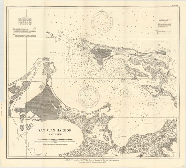
Subject: San Juan, Puerto Rico

Period: 1899 (dated)

Publication:

Color: Black & White

Size:
25.6 x 22.5 inches
65 x 57.2 cm
Download High Resolution Image
(or just click on image to launch the Zoom viewer)

This map was issued shortly after Puerto Rico was ceded to the United States as result of the Treaty of Paris in 1898 (ending the Spanish-American war). The chart shows the street grid pattern of San Juan, Catano, Isla de Cabras, and the surrounding area. The harbor is filled with depth soundings, shoals, buoys, and two large compasses showing magnetic variation. Originally published by the Coast & Geodetic Survey with additions by the U.S. Fish Commission.

References:

Condition: A+

Issued folding on a clean, bright sheet. Fine.

Estimate: $100 - $130

Sold for: $65

Closed on 2/6/2019

Archived