Catalog Archive
Auction 171, Lot 288

"Map of Texas from the Most Recent Authorities", Thomas, Cowperthwait & Co.
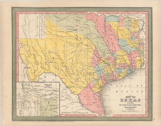
Subject: Texas

Period: 1850 (dated)

Publication: Mitchell's New Universal Atlas

Color: Hand Color

Size:
15 x 12.2 inches
38.1 x 31 cm
Download High Resolution Image
(or just click on image to launch the Zoom viewer)

An excellent early map of the state that was originally engraved by C.S. Williams and published in the final edition of Tanner's Universal Atlas in 1845. Mitchell began to issue the map in his own atlases from 1846 to 1849, making few changes to the plate. This edition shows all of Texas with the panhandle in an inset, "Texas North of the Red River," at lower left. There is great detail of existing counties, towns, and villages, with the mountains indicated via hachure. The comment in the panhandle that claims that the area "as far as North Canadian Fork was explored by Le Grand in 1833, [and] it is naturally fertile, well wooded, and with a fair proportion of water" is from Arrowsmith's 1841 map. Despite the 1850 date in the imprint, the county configuration is only current to 1845, when Texas was admitted as a state. San Patricio occupies the south tip while Milam and Robertson are long counties that begin at the Nacogdoches - San Antonio road and arc to the northwest all the way to the Red River. The map locates Fort Alamo, mines, and the Presidios of Rio Grande, del Norte el de las Yuntas, del Paso del Norte and others. It also delineates many early roads.

Thomas, Cowperthwaite & Co. purchased rights to Mitchell's atlas. Mitchell had made very few changes to this plate since 1846, accounting for the county layout we see here and suggesting this is from the rare first Thomas, Cowperthwait edition. Surrounded by decorative border in characteristic green hand coloring.

References:

Condition: A

There is minor soiling in the blank margins.

Estimate: $900 - $1,100

Sold for: $450

Closed on 2/6/2019

Archived