Catalog Archive
Auction 171, Lot 240

NO RESERVE

"A Plat Exhibiting the State of the Surveys in the State of Florida with References", U.S. State Surveys
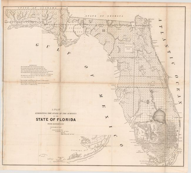
Subject: Florida

Period: 1854 (dated)

Publication:

Color: Black & White

Size:
25.3 x 22.3 inches
64.3 x 56.6 cm
Download High Resolution Image
(or just click on image to launch the Zoom viewer)

This 1853 edition shows up-to-date survey progress and development in the state. The map shows the entire state to include Key Largo and features the Forbes Purchase and the Arredondo Grant lands. Numerous forts are located including Lauderdale, Howell, Foster, Thompson, Adams, and many more. Key Biscayne is identified, but Miami is not yet named. This map was produced in a period of relative peace between the U.S. and Seminole Nation. The third and final Seminole War waged between 1855 and 1858. Extensive legend gives survey status for townships. From the Surveyors Office in St. Augustine, September 30th, 1853 by John Wescott, Surveyor General.

References:

Condition: B+

Issued folding with light toning and scattered foxing that is mostly concentrated along the folds, some minor offsetting, and some short centerfold separations, most of which have been closed with archival materials on verso. A binding trim at left has been replaced with old paper with the neatline replaced in facsimile.

Estimate: $100 - $130

Sold for: $160

Closed on 2/6/2019

Archived