Catalog Archive
Auction 171, Lot 12

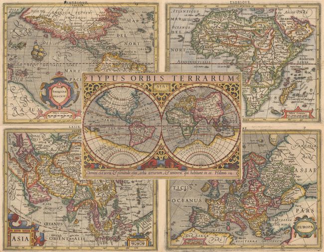
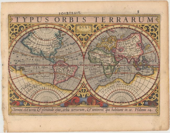
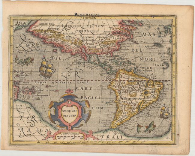
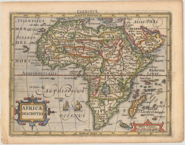
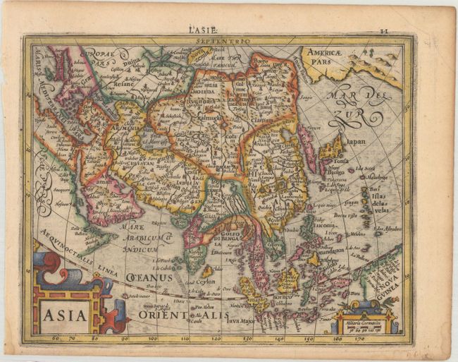
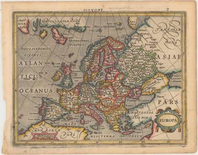
Matching Set from 2nd French Edition of the Atlas Minor

"[Lot of 5] Typus Orbis Terrarum [and] America Descrip. [and] Africae Descriptio [and] Asia [and] Europa", Mercator/Hondius

Subject: World & Continents

Period: 1613 (published)

Publication: Atlas Minor

Color: Hand Color

Size:
7.9 x 5.3 inches
20.1 x 13.5 cm
Download High Resolution Image
(or just click on image to launch the Zoom viewer)

Beautifully engraved, matched set of maps featuring the world and continents from the second French edition of Mercator's Atlas Minor, which was published by Jodocus Hondius, Cornelis Claesz and Jan Jansz. Size varies slightly.

A. Typus Orbis Terrarum is a handsome double hemisphere map based on Mercator's famous world map with several updates. Terra Australis Incognita fills the Southern Hemisphere and connects to New Guinea in the region of Australia. Mercator's Northwest Passage and interesting polar islands have been replaced with a nondescript landmass. The eastern coast of Asia has been revised to include a Korean Peninsula. The map is richly decorated in a strapwork surround with the title at top and Hondius' favorite quotation from Psalms at the bottom. Ref: Shirley #259.

B. Americae Descrip. is a charming reduced version of the Americas map Hondius engraved for Gerard Mercator's folio atlas. It is a combination of various cartographic sources. North America is greatly elongated with a Plancius type depiction of Newfoundland and a protruding Virginian coast, and the west coast is separated by only a narrow strait from Asiae Pars. South America is shown with a more or less correct western coastline and there is a large southern continent incorporating New Guinea and Tierra del Fuego. Decorated with sea monsters, sailing ships, and a strapwork title cartouche. Ref: Burden #153.

C. Africae Descriptio is based on Hondius' superb map of the continent. Using the Mercator model, there are revisions to the coastlines, particularly that of Madagascar. Hondius improved the Cape area by inserting Saldanha Bay and Cape Falco and discarding Cayneca. The map is crisply engraved and decorated with strapwork title and distance scale cartouches, a sea monster, and a sea battle off the coast of C. Negro. Ref: Betz #53; Norwich #27a.

D. Asia is a small version of Hondius' important map of the continent and the East Indies. Korea appears as a long island and an exaggerated Gulf of Cambay distorts the Indian subcontinent. The extreme eastern part of the map shows a bit of the coastline of America with the label Americae Pars separated from Asia by the Anian Fretum. The map is decorated with a pair of strapwork cartouches for the title and scale of miles. Ref: Yeo #21.

E. Europa is a small version of Gerard Mercator's folio map of Europe. America Pars appears in the upper left corner along with Lester Point, part of Greenland, Iceland, and the mythical island of Frisland. The map is graced with strapwork title and scale cartouches.

References: Van der Krogt (Vol. III) #0001:351, 1000:351, 8000:351, 8600:351, 9000:351.

Condition: A

Dark impressions with minor toning and soiling along the edges of the sheets. Several of the sheets have light damp stains confined to the blank margins, and the alternate titles printed at top touch or enter the neatline on all but the map of Asia. The map of Asia has a faint spot in the title cartouche.

Estimate: $2,750 - $3,500

Unsold

Closed on 2/6/2019

Archived