Catalog Archive
Auction 170, Lot 689

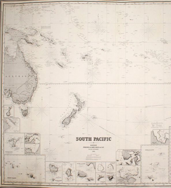
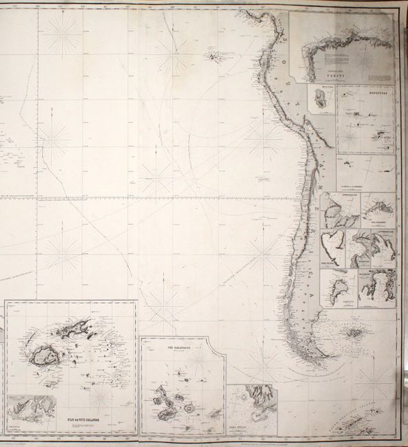
"South Pacific", Imray, James

Subject: South Pacific Ocean

Period: 1865 (dated)

Publication:

Color: Black & White

Size:
73.6 x 40.1 inches
186.9 x 101.9 cm
Download High Resolution Image
(or just click on image to launch the Zoom viewer)

This massive blue-backed chart on three joined sheets spans the South Pacific from eastern Australia and Papua New Guinea to western South America. It identifies numerous islands and provides plenty of navigational information, including compass roses, notes, routes, shoals, and banks. Beneath South America are two interesting notes warning of icebergs and "storms and almost constant rain." There are 31 inset charts that zoom in on smaller islands and archipelagoes for additional detail. Among the areas shown in inset are the Society Islands, Tonga, Fiji, the Galapagos, the northwest coast of Tahiti, and the Marquesas. In a note beneath the title, the publishers request feedback "that may tend to the future improvement of this, or any of their works."

References:

Condition: B+

A fine impression with minor soiling and a few archivally repaired edge tears. There are several chips along the top of the map, with portions of the border replaced in facsimile, most notably in the top right corner.

Estimate: $1,000 - $1,300

Unsold

Closed on 11/14/2018

Archived